 2021, Vol. 39
Institute of Oceanology, Chinese Academy of Sciences
Article Information
- LI Gaocong, XIA Xiaoming, JIA Jianjun, WANG Yaping, CAI Tinglu, GAO Shu
- Predicting sediment flux from continental shelf islands, southeastern China
- Journal of Oceanology and Limnology, 39(2): 472-482
- http://dx.doi.org/10.1007/s00343-020-9333-0
Article History
- Received Dec. 25, 2019
- accepted in principle Feb. 23, 2020
- accepted for publication Apr. 21, 2020


2 Second Institute of Oceanography, Ministry of Natural Resources, Hangzhou 310012, China;
3 State Key Laboratory for Estuarine and Coastal Research, East China Normal University, Shanghai 200241, China
Continental shelf islands are widely distributed in global shallow marine environments. Compared with oceanic islands, generated by submarine volcanic activities, these islands are closely correlated with adjacent continents in geographical and geological settings (Whittaker, 1998; Stankowski and Johnson, 2014). Sediment supply to continental shelves is commonly considered to be dominated by two dominant sources, i.e., riverine and shelf-derived sediments (Nittrouer and Wright, 1994; Gao et al., 2011; Jia et al., 2018). However, shallow marine islands, which can also contribute to the deposits, have been often ignored (Li et al., 2018).
In order to quantify the sediment flux from continental shelf islands, long-term hydrologic and sediment observation data is needed. However, it is not available for us to establish empirical equations for the sediment flux calculation of continental shelf islands. One indirect method is to integrate island-wide sediment flux into the continent river-derived sediment flux because they are linked closely in both geographical and geological settings, especially before influenced by intense human activities. Traditionally, two distinct methods are used to quantify riverine suspended sediment flux to oceans. One is estimating the flux based on the denudation rate of continents (e.g., Ahnert, 1970; McLennan, 1993), and the other is analyzing the data from hydrometric stations near river mouths (e.g., Holeman, 1968; Milliman and Syvitski, 1992).
For the first one, the prediction tends are usually overestimated because a large amount of eroded sediments is trapped within the catchment and never reaches the estuary (Milliman and Meade, 1983). For the second method, since not all rivers have hydrometric stations or without well-documented history, empirical formulae are commonly applied. Many empirical formulae, namely the global equations in this study, were developed to predict the sediment flux of continent rivers based on the relationships between fluvial sediment load and catchment parameters (e.g. area, maximum relief, and mean temperature) of hundreds of rivers around the world (Milliman and Syvitski, 1992; Mulder and Syvitski, 1996; Syvitski et al., 2003). In addition, modifications to prediction equations should be considered when using the global equations in specific areas, because significant differences in sediment yield exist between different regions or different sizes of drainage basins (Milliman and Meade, 1983; Milliman et al., 1999).
In this study, the sediment flux of continental shelf islands along the coasts of the East and South China Seas were quantified. First, the sediment load/yield pattern of the rivers catchments in the southeastern coastal regions including Hainan Island in China were considered suitable for this study, and each of the islands were treated as a single catchment. Secondly, two methods were used to calculate the sediment flux off these islands. At last, the effects of treating an island as a single catchment on its sediment flux to adjacent seas and their sedimentological implications were analyzed and discussed.
2 REGIONAL SETTINGThe study area includes 23 coastal rivers and 8 227 continental shelf islands in southeast China (Fig. 1). During the low sea-level periods of the Quaternary ice ages, these islands are connected to the mainland or Hainan Island (Whittaker et al., 2017). The outcrop rocks of these regions composed of almost consistent Cenozoic-Holocene igneous and sedimentary rocks (Gao, 1988). A monsoon climate exists in these areas: northerly winds predominate in winter (from November to March) and southeasterly in summer (from May to September). During summer months, these regions are influenced by typhoons. Cold outbreaks occur with winter storms hitting the coasts in winter (Shanghai Typhoon Research Institute of China Meteorological Administration, 2006; Gao et al., 2016). The annual precipitation is on average of 1 300-2 400 mm, occurring mostly between April and September. The mean yearly temperature for these islands ranges 16-24℃. The waves are moderate, and the tides are semi-diurnal on the East China Sea coast and diurnal on the northern South China Sea coast (Wang et al., 2001).

|
| Fig.1 locations of the study rivers, hydrometric gauging stations, and continental shelf islands The names of the rivers are (1) Jiaojiang; (2) Oujiang; (3) Feiyunjiang; (4) Aojiang; (5) Shuibeixi; (6) Saijiang; (7) Huotongxi; (8) Minjiang; (9) Mulanxi; (10) Jinjiang; (11) Jiulongjiang; (12) Huangganghe; (13) Hanjiang; (14) Rongjiang; (15) Dongjiang; (16) Beijiang; (17) Moyanghe; (18) Jianjiang; (19) Jiuzhouhe; (20) Nanliuhe; (21) Nandujiang; (22) Changhuajiang; (23) Wanquanhe. |
Three data sets are used in this study. The first is the parameters of the environmental background setting of the 23 catchments described above, including area, maximum relief, mean temperature, and mean rainfall. Twenty mountain/highland river systems were included in the mainland. Their mainstream length, maximum relief, and catchment area are within the range of 50-541 km, 596-2 158 m, and 425-60 992 km2, respectively. Three rivers in Hainan Island, i.e., the Nandujiang, Wangquanhe, and Changhuajiang rivers were also included. The second is the characteristic values of 26 hydrometric gauging stations of the rivers, including drainage area and sediment discharge. The third is the area coverage of the shelf islands. The maximum relief and catchment area of the continental shelf islands considered in this study are in the ranges of 0.1-1 404 m and ~0- 490.9 km2, respectively. The total surface area of the islands is 4 418.49 km2 (Xia, 2012).
The sources of the first and second data sets are collected from published sources (Table 1), including mainly Zhang et al. (2015), Water Resources Department of People's Republic of China (2017), and Baidu Wikipedia (http://baike.baidu.com). In order to avoid the inclusion of sediment flux that might be interfered by human activities, only the measurements at the hydrometric gauging stations between the 1950s and 1970s were considered as the sediment discharge. Sediment yield of the catchment was defined as the sediment discharge divided by the drainage area of a hydrometric gauging station. The area coverage data of the 8 227 islands were obtained from the data set in Xia (2012).

In terms of the geological and hydrological settings, assumptions were made to predict the sediment fluxes from the continental shelf islands: (ⅰ) the sediment load/yield derived from continental shelf islands is calculated by the same method as that used for adjacent small coastal catchment rivers; and (ⅱ) each of the islands is taken as a single catchment. As such, two quantitative methods were adopted to obtain the sediment flux.
The first method for predicting the sediment flux of the islands is based on the mean sediment yield of the catchments. As such, the sediment flux of a continental shelf island (Qs) can be quantified by:
 (1)
(1)where Qy is the sediment yield (t/(km2·a)), A is the area of a continental shelf island (km2), and the overbar denotes the average of all the rivers in consideration.
The second method takes the dominant factors of sediment flux into account. Three global empirical equations are modified by using characteristic values of the variables of local rivers. The first equation is from the Milliman and Syvitski (1992) model which predicts sediment flux by catchment area:
 (2)
(2)where Ac is catchment area (106 km2).
The second one was developed by Mulder and Syvitski (1996), which included the factors of basin area and maximum elevation:
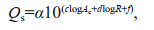 (3)
(3)where α is a constant (=0.031 5, for unit conversion from kg/s to Mt/a), Ac is catchment area (km2), and R is maximum elevation of the catchment (m).
The third one was adopted by Syvitski et al (2003), which is based on average discharge, maximum relief, and mean temperature:
 (4)
(4)where α is a constant (0.031 5), Ac is catchment area (km2), R is maximum relief (m), and T is average temperature of the catchment in consideration (℃).
In Eqs.2-4, the lower-case letters, a, b, c, d, f, g, h, and i, are regression coefficients, determined by least squares methods.
To quantify the difference between measurements and modeling results, we used the sum of relative error squares (RS) which is defined as:
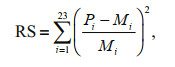 (5)
(5)where Pi and Mi are the predicted and measured values of sediment flux, respectively, and obtained from the results of Eqs.2, or 3, or 4 and the hydrometric gauging station measurements, respectively. A small RS value is indicative of a good fitting. Subsequently, the sediment fluxes for the continental shelf islands are calculated using the best-fit equations.
4 RESULT 4.1 The best-fitted equationFigure 2 shows the three regression equations based on Eqs.2-4, and their RS values. The results indicate that the relative error squares of the three equations for the catchments are small, i.e., generally below 0.25, although some of them were deviated by a factor of 2.5 to 3.25. When factor Ac is considered alone, the RS (4.408 8) value is the smallest. For the equation including Ac, R, and T, the RS (5.941 8) value is the largest. And for the equation based on Ac and R, the RS (4.425 2) value is in between. Thus, we use the best-fitted equation for the prediction of island sediment flux:
 (6)
(6)

|
| Fig.2 Relationships between drainage areas and relative error squares between predictions and measurements of the mainland and Hainan Island catchments Light yellow area denotes the zoom in zone from 0 to 5 000 km2 of Ac and 0 to 0.25 of residual squares of prediction from the measurement. Light blue area denotes three regression equations that were associated with by Eqs.2, 3 and 4. |
where A (106 km2) is the area of a continental shelf island.
4.2 Island sediment fluxesThe sediment fluxes from the islands in study area show a significant spatial trend, which are closely related to the size of the islands (Fig. 3). The reason is that Qs has a linear or power function relationship with A according to Eqs.1 and 6. For both equations, the magnitude of Qs is similar, ranging between 100 and 104 t/a. In terms of total Qs of the islands, the results of two prediction methods are also close: Eq.1 predicts a value of 0.86 Mt/a, whilst Eq.6 predicts a slightly higher value of 1.14 Mt/a. Generally, the total flux has an order of magnitude of 100 Mt/a.

|
| Fig.3 Spatial distribution patterns of the area (a), and Qs predicted by Eq.1 (b) and Eq.5 (c) for the shelf islands |
One of the key issues to accurately interpret the sedimentary records of continental shelves is the sediment sources and their magnitude. The knowledge of sediment flux from islands is an important supplement for the continental shelf sedimentary record studies. In this study, based on the similarities between land catchments and shelf islands in terms of sediment load/yield, the total sediment flux is estimated. Whether or not this value is valid depends on the validity of the two assumptions made in the calculations. For the first assumption, because hydrometric gauging stations for continental shelf islands are rare, it is difficult to directly verify the consistency of sediment load/yield pattern between land rivers and continental shelf islands.
An indirect method is to use the model predictions for the adjacent mainland-based coastal catchments. Here, the global equations are adopted, using the characteristic values of variables of the river basins of the mainland and Hainan Island with regional signatures. The best fit function and sediment yield equation are selected to predict Qs for the shelf islands. The outcomes of the two methods are similar, which indicate the feasibility of the first assumption.
For the second assumption, a continental shelf island is treated as a single catchment. However, a continental shelf island can contain several catchments in reality. Because of the lack of detailed area data of the "sub-catchments" for the islands, it is not practicable to calculate the sediment flux by a treatment of the sub-catchments. Instead, each of the islands is treated as a single catchment in this study.
The effects of such an assumption need evaluations. Let An be the area of the nth catchment of an island, so that we have:
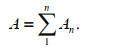 (7)
(7)Then, we introduce the index of P1 and P2 for assessing the difference which are defined as:
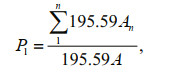 (8)
(8)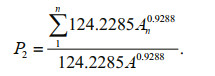 (9)
(9)Since whatever n is, the value of P1 is a constant (=1), the number of sub-catchments of an island does not affect the total flux prediction using Eq.1.
For Eq.9, if n=1, then P2=1; if n > 1, it can be re-written as:
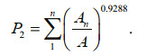 (10)
(10)When A2=A2 … =An, the P2 value approaches a maximum. Hence, the upper limit of P2 becomes:
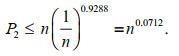 (11)
(11)Therefore, when treating an island as a single catchment and using Eq.6, the prediction generates the lower limit of the sediment flux. The modified value will be larger than it by a factor of (n0.0717-1) (Fig. 4). Thus, the degree of underestimation is related to the number of the sub-catchments of an island.

|
| Fig.4 Relationships between the number of sub-catchments of an island (n) and P1 or P2 regardless the catchment area distribution The domain of n is [1, 100]. |
Assuming that the number of the sub-catchments of each of the continental shelf islands is below 100, P2 will range between 1 and 1.38. The total sediment flux from the islands ranges between 1.13 and 1.56 Mt/a. This magnitude is comparable to that of the small local rivers, such as the Jiaojiang (0.76 Mt/a), Moyang (0.78 Mt/a), and Nanliu (1.15 Mt/a) rivers (Table 1). Therefore, the sediment supply from continental shelf island is significant and should not be neglected.
5.2 The geologic implications of the shelf island sediment supplyMany studies had provided sedimentary insights into the Zhoushan Archipelago sediment supply for the adjacent areas, including a focus on the grain size (Yan et al., 1981; Li et al., 2002; Hu et al., 2009), clastic minerals (Sha, 2007), geochemical province (Liu et al., 2012), and sedimentary rate (Xu et al., 2012; Gao, 2013; Zhang et al., 2014; Gao et al., 2015). Based on their outcomes, the general pattern is that coarse sediments derived from the Zhoushan Archipelago are mainly deposited near the island shorelines, and the fine-grained materials may deposit further away from the shoreline (Li et al., 2018). We could deduce that the sediment supply of the distal muds associated with large rivers.
In terms of the magnitude of sediment supply to the Changjiang River distal mud deposits, the total contribution of continental shelf islands is important compared with the small local rivers (Table 1). The sedimentary materials supplied by the Changjiang River is the largest (108 t/a), followed by the rivers discharging into the Zhejiang and Fujian coasts (104-106 t/a) and the total contribution of the adjacent continental shelf islands (105 t/a). Nevertheless, in response to the disturbance of human activities in the Changjiang River catchment, its sediment supply has been reduced significantly, enhancing the relative importance of the island derived sediment supply in the future.
During the Holocene, the sediment input from islands is a potent source to the shelf sedimentary systems. In present era, distal mud deposits occur in both Changjiang and Zhujiang (Pearl) rivers, but the large-scale sediment escape from their estuary did not start at the early stage of distal muds evolution (Gao et al., 2015; Li et al., 2018). According to the sedimentary characteristics of distal muds of Changjiang and Zhujiang rivers (Xu et al., 2012; Liu et al., 2014; Gao et al., 2015), large-scale sediment escape from the Changjiang Estuary did not occur until 2 ka ago, whereas that of the Zhujiang River started only around 100 a ago. Before these times, most of the sediment from the two rivers were trapped within the bay-head areas and estuarine waters (Gao et al., 2015).
Thus, their contribution to the distal muds should be very limited. The sediment supply from the local small rivers and the continental shelf islands could be two important sources of the formulation of the mud deposit areas back then. Afterward, the sediment from the major rivers dominates the sedimentary system that forms the deltaic distal muds. Although the sediment flux of each island is relatively small, the large number of islands combine together that have the possibility to generate a detectable contribution to the distal muds. In particular, they provide both coarse- and fine-grained sediments throughout the life cycle of distal muds because of the short transport distance from the islands towards the distal muds.
Since the 1980s, there have been increasing attentions to continental shelf distal mud deposits that are closely related to large river deltas (Nittrouer et al., 1986; Kuehl et al., 1997; Correggiari et al., 2001; Warne et al., 2002; Cattaneo et al., 2003; Neill and Allison, 2005; Liu et al., 2001, 2009, 2014). Distal mud deposits are characterized by the inputs of suspended sediments mainly from continental rivers that accumulate within well-defined areas (Gao and Collins, 2014; Gao et al., 2015). However, the contribution of continental islands to the sediment flux of distal mud deposits is usually ignored. In fact, continental shelf islands not only provide continuously additional sediments, but also influence the shelf currents. Therefore, the following studies should be carried out in future: (1) identification of the island-derived sediment within the continental shelf mud deposits; and (2) assessment of the role of continental shelf islands in the formation of distal mud deposits. Additional in situ observations and sampling, together with numerical modeling efforts, are needed to understand the continent-sea-island interactions.
6 CONCLUSION(1) The best fit function for predicting the sediment flux of the continental shelf islands in study area is derived. By treating an island as a single catchment, a lower limit of the sediment flux is obtained, but the actual value is larger than that by a factor of (n0.0717-1) (n is the number of the sub-catchments of a continental shelf island).
(2) The sediment supply from the islands is estimated to be in the order of 1 Mt/a. This amount is comparable to that of the local rivers, which represents an important sediment source to continental shelf sedimentary system and should not be neglected.
(3) For the present-day Changjiang River distal mud and the Zhujiang River distal mud areas, the two rivers delivered a limited quantity of sediment 2 ka and 100 a ago, respectively. At those times, the sediment discharged from small local rivers and continental shelf islands should serve as a major sediment source.
7 DATA AVAILABILITY STATEMENTIn this study, three data sets were used to estimate the sediment flux from continental islands, SE China. The first is the parameters of environmental background setting of the 23 coastal catchments, including area, maximum relief, mean temperature, and mean rainfall. The second is the characteristic values of 26 hydrometric gauging stations of the rivers, including drainage area and sediment discharge. The third is the area coverage of the shelf islands that pertains to the dataset in Xia (2012). The data sources of the first and two categories are collected from published literatures (Table 1), mainly Zhang et al. (2015), Water Resources Department of People's Republic of China (2017), and the Baidu Wikipedia (http://baike.baidu.com). The first two datasets are open to public readers, but the last dataset is not available and is privileged information belonging to the Ministry of Natural Resources of China.
8 AUTHOR CONTRIBUTIONXiaoming XIA, Jianjun JIA, and Tilu CAI produced the island's dataset; Shu GAO, Jianjun JIA, and Gaocong LI conceived and posed the research question, and carried out the analysis, and Gaocong LI wrote the paper; Gaocong LI, Yaping WANG, and Shu GAO designed the study and interpreted the results. All authors commented on the manuscript..
9 ACKNOWLEDGMENTAnonymous reviewers are thanked for their reviews of the original manuscript.
Ahnert F. 1970. Functional relationships between denudation, relief, and uplift in large, mid-latitude drainage basins. American Journal of Science, 268(3): 243-263.
DOI:10.2475/ajs.268.3.243 |
Cattaneo A, Correggiari A, Langone L, Trincardi F. 2003. The late-Holocene Gargano subaqueous delta, Adriatic shelf: sediment pathways and supply fluctuations. Marine Geology, 193(1-2): 61-91.
DOI:10.1016/S0025-3227(02)00614-X |
Chen B. 1988. Water and sediment characteristics and channel evolution in the lower reach of the Mulan River. Hydraulic Science and Technology, (1): 47-51.
(in Chinese) |
Chen H W, Chen W L. 2006. Analysis of hydrologic characteristics of Moyangjiang river basin. Guangdong Water Resources and Hydropower, (2): 60-61, 65.
(in Chinese) DOI:10.3969/j.issn.1008-0112.2006.02.024 |
Chen R Z, Lu S S, Cai T L, Liu Y F. 2016. Variations in water and sediment fluxes in the Jiaojiang River. Journal of Sediment Research, (6): 25-31.
(in Chinese with English abstract) DOI:10.16239/j.cnki.0468-155x.2016.06.005 |
Chen S H. 2010. Analysis of hydrological characteristic of Rongjiang river basin. Pearl River, 31(4): 10-11, 41.
(in Chinese with English abstract) |
Chen S J. 2007. Analysis on the sediment status and changes in the streams of the East Fujian Province. Subtropical Soil and Water Conservation, 19(4): 20-23.
(in Chinese with English abstract) DOI:10.3969/j.issn.1002-2651.2007.04.006 |
Chen Y N, Chen N W, Li Y, Hong H S. 2018. Multi-timescale sediment responses across a human impacted river-estuary system. Journal of Hydrology, 560: 160-172.
DOI:10.1016/j.jhydrol.2018.02.075 |
Correggiari A, Trincardi F, Langone L, Roveri M. 2001. Styles of failure in late Holocene highstand prodelta wedges on the Adriatic shelf. Journal of Sedimentary Research, 71(2): 218-236.
DOI:10.1306/042800710218 |
Gao S, Collins M B. 2014. Holocene sedimentary systems on continental shelves. Marine Geology, 352: 268-294.
DOI:10.1016/j.margeo.2014.03.021 |
Gao S, Liu Y L, Yang Y, Liu J P, Zhang Y Z, Wang Y P. 2015. Evolution status of the distal mud deposit associated with the Pearl River, northern South China Sea continental shelf. Journal of Asian Earth Sciences, 114: 562-573.
DOI:10.1016/j.jseaes.2015.07.024 |
Gao S, Wang D D, Yang Y, Zhou L, Zhao Y Y, Gao W H, Han Z C, Yu Q, Li G C. 2016. Holocene sedimentary systems on a broad continental shelf with abundant river input: process-product relationships. Geological Society, London, Special Publications, 429(1): 223-259.
DOI:10.1144/SP429.4 |
Gao S, Wang Y P, Gao J H. 2011. Sediment retention at the Changjiang sub-aqueous delta over a 57 year period, in response to catchment changes. Estuarine, Coastal and Shelf Science, 95(1): 29-38.
DOI:10.1016/j.ecss.2011.07.015 |
Gao S. 1988. P-A relationships of tidal inlets along the East China Sea coast. Marine Sciences, (1): 15-19.
(in Chinese with English abstract) |
Gao S. 2013. Holocene shelf-coastal sedimentary systems associated with the Changjiang River: an overview. Acta Oceanologica Sinica, 32(12): 4-12.
DOI:10.1007/s13131-013-0390-5 |
Holeman J N. 1968. The sediment yield of major rivers of the world. Water Resources Research, 4(4): 737-747.
DOI:10.1029/WR004i004p00737 |
Hu R J, Wu J Z, Li G X, Zhu L H, Ma F. 2009. Characteristics of sediment transport in the Zhoushan Archipelago sea area. Acta Oceanologica Sinica, 28(5): 116-127.
|
Huang X Q. 2008. Hydrological characteristics of the Jiulong River Catchment. Hydraulic Science and Technology, (1): 16-17, 20.
(in Chinese) |
Huang Z M. 2010. Hydrological characteristics of the Jian River Catchment. Modern Technology, 9(3): 37-39.
(in Chinese) |
Jia J J, Gao J H, Cai T L, Li Y, Yang Y, Wang Y P, Xia X M, Li J, Wang A J, Gao S. 2018. Sediment accumulation and retention of the Changjiang (Yangtze River) subaqueous delta and its distal muds over the last century. Marine Geology, 401: 2-16.
DOI:10.1016/j.margeo.2018.04.005 |
Kuehl S A, Levy B M, Moore W S, Allison M A. 1997. Subaqueous delta of the Ganges-Brahmaputra river system. Marine Geology, 144(1-3): 81-96.
DOI:10.1016/s0025-3227(97)00075-3 |
Li G C, Gao S, Wang Y P, Li C Y. 2018. Sediment flux from the Zhoushan Archipelago, eastern China. Journal of Geographical Sciences, 28(4): 387-399.
DOI:10.1007/s11442-018-1479-8 |
Li Y Z, Cheng S L, Gu G C. 2002. Modern sedimentation environment in Qiqu Archipelago. Shanghai Geology, (2): 11-16.
(in Chinese with English abstract) DOI:10.3969/j.issn.2095-1329.2002.02.003 |
Liu J P, Milliman J D, Gao S. 2001. The Shandong mud wedge and post-glacial sediment accumulation in the Yellow Sea. Geo-Marine Letters, 21(4): 212-218.
DOI:10.1007/s00367-001-0083-5 |
Liu J P, Xue Z, Ross K, Wang H J, Yang Z S, Li A C, Gao S. 2009. Fate of sediments delivered to the sea by Asian large rivers: long-distance transport and formation of remote alongshore clinothems. The Sedimentary Record, 7(1): 4-9.
DOI:10.2110/sedred.2009.4.4 |
Liu S F, Liu Y G, Yang G, Qiao S Q, Li C X, Zhu Z W, Shi X F. 2012. Distribution of major and trace elements in surface sediments of Hangzhou Bay in China. Acta Oceanologica Sinica, 31(4): 89-100.
DOI:10.1007/s13131-012-0223-y |
Liu Y L, Gao S, Wang Y P, Yang Y, Long J P, Zhang Y Z, Wu X D. 2014. Distal mud deposits associated with the Pearl River over the northwestern continental shelf of the South China Sea. Marine Geology, 347: 43-57.
DOI:10.1016/j.margeo.2013.10.012 |
McLennan S M. 1993. Weathering and global denudation. The Journal of Geology, 101(2): 295-303.
DOI:10.1086/648222 |
Milliman J D, Farnsworth K L, Albertin C S. 1999. Flux and fate of fluvial sediments leaving large islands in the East Indies. Journal of Sea Research, 41(1-2): 97-107.
DOI:10.1016/S1385-1101(98)00040-9 |
Milliman J D, Meade R H. 1983. World-wide delivery of river sediment to the oceans. The Journal of Geology, 91(1): 1-21.
DOI:10.1086/628741 |
Milliman J D, Syvitski J P M. 1992. Geomorphic/tectonic control of sediment discharge to the ocean: the importance of small mountainous rivers. The Journal of Geology, 100(5): 525-544.
DOI:10.1086/629606 |
Ministry of Water Resources and Electricity. 1982. Hydrological Statistics of the Main Rivers in China. Ministry of Water Resources and Electricity, Beijing, China. p. 1-538. (in Chinese)
|
Mulder T, Syvitski J P M. 1996. Climatic and morphologic relationships of rivers: implications of sea-level fluctuations on river loads. The Journal of Geology, 104(5): 509-523.
DOI:10.1086/629849 |
Neill C F, Allison M A. 2004. Subaqueous deltaic formation on the Atchafalaya Shelf, Louisiana. Marine Geology, 214(4): 411-430.
DOI:10.1016/j.margeo.2004.11.002 |
Nittrouer C A, Kuehl S A, Demaster D J, Kowsmann R O. 1986. The deltaic nature of Amazon shelf sedimentation. GSA Bulletin, 97(4): 444-458.
DOI:10.1130/0016-7606(1986)97<444:TDNOAS>2.0.CO;2 |
Nittrouer C A, Wright L D. 1994. Transport of particles across continental shelves. Reviews of Geophysics, 32(1): 85-113.
DOI:10.1029/93rg02603 |
Sha X G. 2007. Sedimentary Characteristics and Provenance of the Mud Sediments in the Zhoushan Area of the East China Sea. MS Thesis of Jilin University, Changchun, China. p. 165. (in Chinese with English abstract)
|
Shanghai Typhoon Research Institute of China Meteorological Administration. 2006. Climatological Atlas for Tropical Cyclones Affecting China (1951-2000). Science Press, Beijing, China. p. 177. (in Chinese)
|
Shao H F. 1991. Variation on sediment load of three major rivers of Fujian Province, China. Fujian Soil and Water Conservation, (1): 42-46.
(in Chinese) |
Song L, Xia X M, Liu Y F, Cai T L. 2012. Variations in water and sediment fluxes from Oujiang River to Estuary. Journal of Sediment Research, (1): 46-52.
(in Chinese with English abstract) DOI:10.3969/j.issn.0468-155X.2012.01.008 |
Stankowski S, Johnson M S. 2014. Biogeographic discordance of molecular phylogenetic and phenotypic variation in a continental archipelago radiation of land snails. BMC Evolutionary Biology, 14(1): 2.
DOI:10.1186/1471-2148-14-2 |
Sun Y, Cai T L, Chai J L, Jin R Y. 1983. The runoff characteristic and its influence on erosion and accretion of mountain rivers estuaries in Zhejiang and Fujiang provinces. Donghai Marine Science, (2): 29-35.
(in Chinese) |
Syvitski J P M, Peckham S D, Hilberman R, Mulder T. 2003. Predicting the terrestrial flux of sediment to the global ocean: a planetary perspective. Sedimentary Geology, 162(1-2): 5-24.
DOI:10.1016/S0037-0738(03)00232-X |
Wang W J, Huang J S, Mao S Z, Li S N. 1991. Modern Deposition of Coastal and Offshore in South China. Science Press, Beijing, China. p. 1-125.
(in Chinese)
|
Wang Y, Peter M I, Zhu D K, Zhang Y Z, Tang W W. 2001. Coastal plain evolution in southern Hainan Island, China. Chinese Science Bulletin, 46(1): 90-96.
DOI:10.1007/bf03187244 |
Warne A G, Meade R H, White W A, Guevara E H, Gibeaut J, Smyth R C, Aslan A, Tremblay T. 2002. Regional controls on geomorphology, hydrology, and ecosystem integrity in the Orinoco Delta, Venezuela. Geomorphology, 44(3-4): 273-307.
DOI:10.1016/S0169-555X(01)00179-9 |
Water Resources Department of People's Republic of China. 2017. China River Sediment Bulletin. China Water Conservancy and Hydropower Press, Beijing, China. p. 1-63. (in Chinese)
|
Whittaker R J, Fernández-Palacios J M, Matthews T J, Borregaard M K, Triantis K A. 2017. Island biogeography: taking the long view of nature's laboratories. Science, 357(6354): eaam8326.
DOI:10.1126/science.aam8326 |
Whittaker R J. 1998. Island Biogeography: Ecology, Evolution, and Conservation. Oxford University Press, Oxford, UK. p. 16-90.
|
Wu J F, Chen X W, Gao L, Chen Y, Liu M B. 2017. Quantitative assessment of runoff changes under the impact of human activities in the Jinjiang River basin. South-to-North Water Transfers and Water Science & Technology, 15(2): 65-72, 79.
(in Chinese with English abstract) DOI:10.13476/j.cnki.nsbdqk.2017.02.010 |
Xia X M. 2012. China Island (Reef) List. Ocean Press, Beijing, China. pp. 1-200. (in Chinese)
|
Xie T. 2013. On the stormy flood characteristics of the Jiuzhou River Catchment during the August 2013. Gansu Water Resources and Hydropower Technology, 49(11): 6-8.
(in Chinese) |
Xu G Q, Ou F L. 2008. Sediment dynamics of the Nanliu River and its relationship with human activities. In: Proceedings of 2007 Symposium of the China Hydroelectric Engineering Society of Hydrology and Sediment. Hydrologic and sediment Committee of China Hydroelectric Engineering Society. Hangzhou, China. pp. 69-75. (in Chinese)
|
Xu K H, Li A C, Liu J P, Milliman J D, Yang Z S, Liu C S, Kao S J, Wan S M, Xu F J. 2012. Provenance, structure, and formation of the mud wedge along inner continental shelf of the East China Sea: a synthesis of the Yangtze dispersal system. Marine Geology, 291-294: 176-191.
DOI:10.1016/j.margeo.2011.06.003 |
Yan Q S, Xiang L S, Zhang G D, Wang H Z, Wu B Y, Dong R X. 1981. Modern coastal sediments of Putuo Island, Zhoushan Archipelago. Acta Geological Sinica, 55(3): 205-215.
(in Chinese with English abstract) |
Yang C X, Zhang Z D, Zhang Q, Dong C W, Wan L W. 2017. Characteristics of multi-scale variability of water discharge and sediment load in the Hanjiang River during 1955-2012. Journal of South China Normal University (Natural Science Edition), 49(3): 68-75.
(in Chinese with English abstract) DOI:10.6054/j.jscnun.2017114 |
Yang Z H, Jia J J, Wang X K, Gao J H. 2013. Characteristics and variations of water and sediment fluxes into the sea of the top three rivers of Hainan in recent 50 years. Marine Science Bulletin, 32(1): 92-99.
(in Chinese with English abstract) |
Zhang B H, Wu X G, Xie D F. 2015. Variation of water and sediment in rivers to sea in recent five decades in Zhejiang Province. Journal of Sediment Research, (6): 21-26.
(in Chinese with English abstract) DOI:10.16239/j.cnki.0468-155x.2015.06.004 |
Zhang W, Mu S S, Zhang Y J, Chen K M. 2011. Temporal variation of suspended sediment load in the Pearl River due to human activities. International Journal of Sediment Research, 26(4): 487-497.
DOI:10.1016/S1001-6279(12)60007-9 |
Zhang X Q, Chen Y Q, Chen H K, Li J H. 2013. Assessment on the soil erosion of the Huanggang River in eastern Guangdong province based on GIS and RUSLE. Soil and Water Conservation in China, (2): 34-37.
(in Chinese with English abstract) |
Zhang X, Lin C M, Dalrymple R W, Gao S, Li L Y. 2014. Facies architecture and depositional model of a macrotidal incised-valley succession (Qiantang River estuary, eastern China), and differences from other macrotidal systems. GSA Bulletin, 126(3-4): 499-522.
DOI:10.1130/B30835.1 |
Zhang Z X. 2000. Analysis of hydrological characteristics of Minjiang river basin. Hydrology, 20(6): 55-58.
(in Chinese with English abstract) DOI:10.3969/j.issn.1000-0852.2000.06.017 |