 2019, Vol. 37
Institute of Oceanology, Chinese Academy of Sciences
Article Information
- YANG Bing, HOU Yijun, LI Min
- Response of the western North Pacific subtropical ocean to the slow-moving super typhoon Nanmadol
- Journal of Oceanology and Limnology, 37(3): 938-956
- http://dx.doi.org/10.1007/s00343-019-8114-0
Article History
- Received Apr. 24, 2018
- accepted in principle Jun. 18, 2018
- accepted for publication Jul. 31, 2018


2 Key Laboratory of Ocean Circulation and Waves, Chinese Academy of Sciences, Qingdao 266071, China;
3 Laboratory for Ocean and Climate Dynamics, Qingdao National Laboratory for Marine Science and Technology, Qingdao 266237, China;
4 Institute of Oceanographic Instrumentation, Shandong Academy of Sciences, Qingdao 266001, China
In the western North Pacific subtropical ocean (WNPSO), typhoons are intense atmospheric storm system characterized by a low-pressure center and strong rotating wind. They interact with the oceans when pass over, and the associated matter, heat and momentum exchanges between the atmosphere and the ocean can evoke upper ocean thermohaline and dynamical responses. The uncertainty of the occurrence and pathway of typhoon makes observation of the oceanic responses difficult. The study of oceanic responses to typhoons is critical for understanding the air-sea interactions that determines the development and translation of typhoons (Ginis, 2002). As typhoon threats severely to a huge population in the East and Southeast Asia, understanding the controlling factors for typhoon intensity is of great importance. The oceanic states account for the development of typhoons, and consequently knowledge of the oceanic responses is necessary.
The oceanic thermohaline responses are generally cooling of the mixed layer (ML) and warming of the thermocline. The ML cooling is mainly induced by vertical entrainment; despite upwelling and upward heat flux at the air-sea interface also play a part (Price, 1981; D'Asaro, 2003). The amplitude of the surface cooling strongly depends on the pre-typhoon ML depth and the stratification in the thermocline, in addition to parameters of typhoons such as intensity and translation speed (Lin et al., 2009; Knaff et al., 2013; Mei and Pasquero, 2013; Yang et al., 2015b). Previous researches suggest that typhoon-induced sea surface temperature (SST) decrease is generally 1–6℃ and is rightward biased (Price, 1981; D'Asaro et al., 2007; Meyer et al., 2016; Zhang et al., 2016). The typhoon-induced sea surface cooling is a negative feedback onto typhoon intensity by reducing air-sea heat fluxes (Emanuel, 1999; Bell and Montgomery, 2008; Mei et al., 2012; Vincent et al., 2014).
Response of the sea surface salinity to typhoons is a combined result of several competing effects, that is, the wind-generated vertical mixing and upwelling which usually leads to salinity increase and rainfall that reduces sea surface salinity. Field observations indicated that typhoon-induced sea surface salinity increase can reach 0.6–0.7 practical salinity unit and the salinity decrease in the thermocline is 0.4 (Maneesha et al., 2012; Domingues et al., 2015). However, equivalent increase and decrease of ML salinity was also found in observation (Liu et al., 2014, 2017). The salinity potentially plays an important role on upper ocean responses through producing a near-surface barrier layer (Domingues et al., 2015).
The oceanic dynamical responses are characterized by ML near-inertial oscillations, and upward and downward propagating near-inertial waves (NIWs). Previous researches have elucidated the general characteristics of NIWs induced by tropical cyclones: (1) they are generated by typhoon winds and concentrated around the typhoon wake (Gill, 1984; Alford et al., 2016); (2) their frequencies are usually blue-shifted to 1.01–1.2f0 (f0 is the local inertial frequency), while red-shift also occurs (Yang and Hou, 2014; Yang et al., 2015b;); and (3) their vertical and lateral scales are typically hundreds of meters and tens to hundreds of kilometers, respectively (Alford et al., 2016).
The WNPSO has the highest concentration of tropical cyclones in the world (D'Asaro et al., 2011), and on average there are 16 typhoons per year (Webster et al., 2005). Previous studies on oceanic responses to typhoons in the WNPSO and the adjacent South China Sea (SCS) either focused on the thermohaline and biological responses (Kuo et al., 2011; Chen et al., 2012; Lin, 2012; Yang et al., 2012; Ko et al., 2014; Wang et al., 2016; Li and Wen, 2017) or the dynamical response (Chen et al., 2013; Yang and Hou, 2014; Yang et al., 2015a). The entrainment and upwelling induced sea surface cooling was generally 2–6℃, and the maximum cooling reached -10.8℃ (Chiang et al., 2011). The generation of NIWs depends on the pre-typhoon ocean status and the typhoon characteristics, and the propagation of NIWs were influenced by mesoscale eddies (Sun et al., 2011; Yang et al., 2015b; Shu et al., 2016). However, simultaneous analysis of the oceanic thermohaline and dynamical responses were relatively few (Tseng et al., 2010; Guan et al., 2014; Yang et al., 2015b).
In August 2011, super typhoon Nanmadol passed over the WNPSO, and a mooring deployed in the Luzon Strait captured the upper ocean responses. Nanmadol is distinctive for its slow translation speed (0.3–5.7 m/s) and strong intensity (category 5). The study intends to investigate the upper ocean thermohaline and dynamical responses, and explore the role played by the translation speed and intensity of Nanmadol. The rest of the paper is organized as follows: information of Nanmadol and the in-situ observation as well as the methodology are introduced in Section 2; the oceanic dynamical responses are shown in Section 3; the oceanic thermohaline responses are presented in Section 4; finally, Section 5 presents the discussion and conclusion.
2 TYPHOON, DATA AND METHODOLOGY 2.1 Typhoon NanmadolSuper typhoon Nanmadol is the 14th tropical cyclone in 2011 western North Pacific typhoon season. The former depression formed over the ocean east of the Luzon Island on August 21. On August 23, the depression upgraded to a tropical storm and was named Nanmadol. Early on August 24, Nanmadol intensified to a severe tropical storm, and became a typhoon by midnight on that day. Then Nanmadol continued to intensify as it moved northwestward and intensified to a Category 5 super typhoon on August 26. Nanmadol weakened significantly after made its first landfall on the Luzon Island. Late on August 28, Nanmadol made its second landfall on the Taiwan Island and started to weaken. Nanmadol downgraded to a tropical storm on August 29. Afterwards, Nanmadol moved into the Taiwan Strait and gradually dissipated on August 30. The radius of the last closed isobar of Nanmadol ranges from 330 km to 400 km, which is smaller on August 25 and 26. The data of Nanmadol used in this paper are from the Joint Typhoon Warning Center (JTWC).
2.2 DATAThe location of the mooring is shown in Fig. 1, and the local water depth is 3 500 m. The local inertial frequency (f0) is 0.684 0 cycles per day (cpd) corresponding to an inertial period of 35.09 h. Horizontal velocity was obtained by a 150-kHz Teledyne RD Instruments acoustic Doppler current profiler (ADCP) from August 26 to October 7. The ADCP, located at a water depth of about 310 m, was up-looking and detected horizontal velocity from 50 m to 300 m below the sea surface. The horizontal velocity data had a temporal interval of 5 min and a vertical interval of 4 m. The Argo drifting floats data were utilized to examine the upper ocean temperature and salinity responses. The SST data from the Remote Sensing Systems (RSS) were adopted to diagnose the SST revolution. The microwave plus infrared optimally interpolated product was used given that the product combines the through-cloud capabilities of the microwave data with the high spatial resolution of the infrared data. The RSS SST data have a temporal resolution of 1 day and a spatial resolution of 9 km. The wind product from the ERA-Interim dataset released by the European Centre for Medium-Range Weather Forecasts (ECWMF) was utilized to calculate wind stress. The wind data have a temporal resolution of 6-hour and a spatial resolution of 1/12°. All satellites merged sea level anomaly (SLA) and absolute dynamic topography (ADT) from the Archiving, Validation, and Interpretation of Satellite Oceanographic (AVISO) dataset were adopted to detect mesoscale eddies and estimate background vortices. The SLA and ADT data have a temporal resolution of 1 day and a spatial resolution of 1/4°. The August statistical mean and 1/4° temperature and salinity data from the World Ocean Atlas 2013 (WOA13) dataset were adopted to calculate the climatology buoyancy frequency.

|
| Fig.1 Topography of the western North Pacific subtropical ocean with the 3 000 m isobaths based on the ETOPO-1 dataset (Amante and Eakins, 2009) The location of the mooring and the track of Nanmadol are denoted by the red pentagram and the blue line. The six-hour typhoon center is denoted by asterisk (tropical depression), diamond (tropical storm), square (typhoon) and circle (super typhoon), and the nearby xx/00 represents 00:00 of that day. The Argo floats close to the track of Nanmadol are denoted by circles (pre-typhoon) and triangles (after typhoon) along with the float ID. |
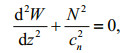
The typhoon translation speed (U) is calculated according to the JTWC data. The climatology first baroclinic internal wave phase speed in August is calculated by solving the vertical mode equation
 (1.1)
(1.1) (1.2)
(1.2) (1.3)
(1.3)where W is the amplitude of the vertical velocity, N is the buoyancy frequency, and cn is nth mode internal wave phase speed. The buoyancy frequency (N) is calculated from the temperature and salinity profile of the WOA13 dataset. Treat c n as eigenvalue, equation (1.1) can be converted to an eigenvalue problem. Then the Mach number (C), which is the ratio of typhoon translation speed (U) to the first mode baroclinic internal wave phase speed (c1), is calculated (Price et al., 1994).
The observed zonal and meridional currents are resampled to 1 hour temporal interval. The rotary spectra of the resampled currents are calculated (Gonella, 1972) and the near-inertial velocity (ui, vi) are derived by a Chebyshev filter with a pass-band of 0.85f0–1.15f0. The near-inertial kinetic energy (NIKE) is calculated by NIKE 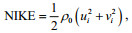
We utilized the damped slab model to simulate the wind-induced ML currents. The model has been verified to competently simulate currents induced by impulsive wind (Pollard and Millard, 1970; Alford, 2001b). The model assumes that wind stress distribute evenly in the ML, and the ML horizontal velocity is given by
 (2)
(2)where u and v is the mixed layer zonal and meridional currents, f0 is the local inertial frequency,
ρ0=1 024 kg/m3 is the reference water density, τx and τy are the zonal and meridional wind stress, H is the ML depth, and r is an empirical damping coefficient (D'Asaro, 1985). The wind stress 


This section analyzes the oceanic dynamical response based on the observed horizontal current in the Luzon Strait. The Mach number C is an important indicator of the oceanic response, and Fig. 2 shows the evolution of U, c1 and C. The typhoon translation speed ranges from 0.3 m/s to 5.7 m/s and shows a speedup as Nanmadol evolves. The first mode baroclinic wave phase speed is around 2.7 m/s east of the Luzon Island, and decreases to 2.2 m/s in the Luzon Strait and 0.3 m/s in the Taiwan Strait. C is smaller than 1 before midday of August 24, and is larger than 1 afterwards. If C is close to 1, the oceanic response will include significant upwelling directly beneath the typhoon and will include a substantial geostrophic component (Geisler, 1970; Greatbatch, 1984). That is the case when Nanmadol is over the ocean east of the Luzon Island. If C is larger than 1, the oceanic response will be wave-like. When Nanmadol passes the Luzon Strait on August 28, C is around 2 which indicate near-inertial oceanic responses.

|
| Fig.2 Evolution of the typhoon translation speed (U), first mode baroclinic internal wave phase speed (c1) at the typhoon center and the Mach number (C) |
The power spectra show that the diurnal, semidiurnal tidal currents and the near-inertial currents dominate the local velocity field (Fig. 3). The diurnal and semi-diurnal tidal currents cover the whole water column; however, the near-inertial currents are confined in the upper ocean (Fig. 3a). At the depth of 112 m, the power of near-inertial currents is comparable to that of the semi-diurnal currents but smaller than the diurnal currents by a factor of 2 (Fig. 3b). The rotary spectra indicate that the nearinertial currents are dominated by clockwise rotating components, while the tidal currents have both clockwise and anticlockwise components. It is noteworthy that power peaks appear at the frequencies of f0+O1 and f0+M2; however, spectra of currents in an isopycnal-following frame show that they are absent which indicates that they are caused by heaving of near-inertial currents by internal tides instead of nonlinear interaction between them (Alford, 2001a).

|
| Fig.3 Depth-frequency plot of power spectra of the original currents (a), power spectra at the depth of 112 m and 240 m (b), and rotary spectra of the original currents (c) The spectra are estimated from current ranging from August 26 to September 26, and the degree of freedom is 6 |
Evolution of near-inertial currents obtained by a band-pass filter is shown in Fig. 4. Energetic nearinertial currents emerge between depth of 48 m and 200 m. The zonal and meridional near-inertial currents reach 0.24 m/s and 0.28 m/s, and the maximum amplitude of near-inertial currents is 0.39 m/s which are smaller than that observed in the SCS (Sun et al., 2011; Yang et al., 2015a). The asymmetry of zonal and meridional currents suggests that the frequency of near-inertial currents shifts away from the local inertial frequency. The near-inertial currents enhance gradually after the passage of Nanmadol and the maximum near-inertial currents occurs in the ocean interior on September 2 which lag the passage of Nanmadol. The lag relates to the vertical propagation of near-inertial energy. According to the 0.05 m/s isograms, near-inertial currents extend to depth of 300 m and sustain for approximately two weeks. The near-inertial currents show an upward phase propagation which is more conspicuous on September 3. The upward phase propagation indicates downward propagation of near-inertial kinetic energy (Gill, 1984).

|
| Fig.4 Time-depth plots of zonal (a) and meridional (b) near-inertial currents The solid (dashed) contours start at 0.05 (-0.05) m/s with an interval of 0.10 m/s |
To explore the vertical propagation of near-inertial energy, we calculate the rotary vertical wavenumber spectra of the near-inertial currents (Fig. 5). The coordinate is WKB-scaled, and the unit of the vertical wavenumber is cycles per stretched meter (cpsm). In small wavenumber band (< 1.1×10⁻² cpsm), the nearinertial energy propagate upward at the early stage (8/26–9/1), and then on September 2 the energy turns to propagate downward. It is noteworthy that the downward energy propagation rate is much higher than the upward one. However, the near-inertial energy propagates upward most of the time in large wavenumber band (>1.1×10⁻² cpsm). The upward propagating near-inertial energy suggests that Nanmadol injects energy into the ocean interior during the forced stage. The energy injection is probably through inertial pumping induced pressure anomaly. Consequently, during the relaxed stage the injected energy propagates upward through higher wavenumber (shorter wavelength) wave component. The temporal accumulation of the rotary vertical wavenumber spectra indicates that net near-inertial energy switches to propagate downward on September 4.

|
| Fig.5 Evolution of the difference (Cm–Am) between the clockwise and anticlockwise rotating with depth components of the rotary vertical wavenumber spectra (a), and the temporal accumulation of the rotary vertical wavenumber spectra (b) The positive (negative) values denote net downward (upward) energy propagation rate and the unit of vertical wavenumber is cycles per stretched meter (cpsm). |
The first empirical orthogonal function (EOF) of the near-inertial currents, with a variation contribution of more than 50%, suggests that near-inertial currents concentrated in the upper 140 m (Fig. 6). The most energetic near-inertial currents appear 100 m below the sea surface, while in shallower water the nearinertial currents show a decrease trend. Around the 170 m, there is a node below which the near-inertial currents are insignificant. The corresponding time series suggest that near-inertial currents commence to intensify after August 29 immediately after the passage of Nanmadol. As the time series exhibit an approximately exponential intensification and attenuation trend, the corresponding e-folding time is calculated to be about 4 days.

|
| Fig.6 Vertical profiles of the first empirical orthogonal function of the observed near-inertial currents (a), and the corresponding time series (b) The blue and red lines represent the zonal and meridional near-inertial currents, respectively. The EOF decomposition is applied to near-inertial currents from August 26 to September 15 |
The aforementioned slab model is adopted to simulate the ML currents (Fig. 7). The mixed depth (H) is set to 40 m according to the stratification, and the damping coefficient (r) is set to 1/4/day based on the aforementioned e-folding time. The wind stress of Nanmadol has a maximum of 0.6 N/m2, and changes rapidly from August 27 to 29. The modeled nearinertial currents correspond well with the observed near-inertial currents in phase, while the modeled near-inertial currents have larger amplitude (Zedler et al., 2009; Guan et al., 2014; Zhang et al., 2016). It is noteworthy that Nanmadol induces considerable unsteady Ekman currents (with maximum amplitude of 0.15 m/s) because Nanmadol moves slowly (about 2.0 m/s) over the Luzon Strait. Moreover, the slowchanging but weaker meridional wind stress induces more energetic Ekman currents than the rapid changing and intense zonal wind stress. The Ekman currents induced by the meridional and zonal wind stress have maximum amplitudes of 0.15 m/s and 0.10 m/s, respectively.

|
| Fig.7 Evolution of wind stress (a), zonal (b) and meridional (c) currents In (b) and (c) the black, green, blue and red lines show the modeled total currents, modeled Ekman currents, modeled near-inertial currents and observed near-inertial currents, respectively |
Vertical profile of peak frequency and phase of near-inertial currents obtained by complex demodulation are shown in Fig. 8. The peak frequency varies dramatically with depth which is blue-shifted above 110 m, red-shifted from 110 m to 220 m and then blue-shifted below 260 m. The blue- and redshift may relate to the propagation of NIWs and/or background vorticity (Fig. 9). The phase of the nearinertial currents shows an evident depth-leading trend corresponds to upward phase speed and downward group speed. As phase of free waves changes 2π in one wave period, the estimated vertical phase speed is 5 m/h which is comparable with former researches (Shay and Elsberry, 1987; Sun et al., 2012) and the corresponding vertical wavelength is 175 m. Accordingly the vertical wavenumber is 0.57×10⁻² cycles per meter (cpm) consistent the most energetic energy band in the rotary vertical wavenumber spectra (Fig. 5).

|
| Fig.8 Vertical profile of the peak frequency with x-axis frequency normalized by local inertial frequency f0, and the full vertical line denotes local inertial frequency f0 (a); vertical profile of the phase of the observed near-inertial currents (b) |

|
| Fig.9 Sea level anomaly (color) and geostrophic current anomaly (arrow) from August 26 to September 3 in 2011 based on the AVISO dataset |
The mooring station is on the edge of an anticyclonic eddy with two cyclonic eddies in its east and north sides (Fig. 9). Afterwards, the anticyclonic eddy moves westward and the cyclonic eddies enhance gradually. The geographic current anomaly vortices are positive from August 26 to August 31, and then the vorticity become negative on September 1 and continue decreasing (Fig. 10). Interestingly, the downward propagation of near-inertial kinetic energy commences after September 1 which is also indicated by the rotary vertical wavenumber spectra (Fig. 5a). The concurrence of downward energy propagation and negative vorticity are consistent with the finding that negative vorticity facilitates downward propagation of near-inertial kinetic energy (Lee and Niiler, 1998; Jaimes and Shay, 2010).

|
| Fig.10 Evolution of the geostrophic current anomaly vortices (a) and the near-inertial kinetic energy (b) |
Prior to the formation of Nanmadol, the SST is generally higher than 28℃. Thus the high SST facilitated the development of Nanmadol as SST higher than 26℃ is commonly believed to promote intensification of tropical cyclones (Fig. 11). Sea surface cooling appeared around the center of Nanmadol on August 24. On August 25, the sea surface cooling area (< 28℃) grew into a stripe along the typhoon track and happened synchronously with the translation of the typhoon center. However, the sea surface cooling enhanced gradually and lagged the passage of the typhoon center by one day from August 26 to 28. In other words, the maximum surface cooling happens one day after the passage of the typhoon center. The lag is related to upwelling induced by the slow-moving typhoon because C is smaller than 1 (Fig. 2). On August 26 and 27, the SST decreased to its minimum (25.5℃) within 50 km on the right side of the typhoon track. Afterwards the sea surface cooling stretched slightly on August 28. On August 29 and 30, the Luzon Strait SST began to drop, and the SST began to recover in the Pacific. Herein we presume the area with SST lower than 28℃ as notable cooling area. Consequently the notable cooling area extends from the typhoon track to about 150 km with a slight right-hand bias. The right-hand bias is slight because upwelling contribute significantly to surface cooling recalling that C is smaller than 1 at the early stage of Nanmadol (Geisler, 1970; Greatbatch, 1984; Mei and Pasquero, 2013; Pun et al., 2018).

|
| Fig.11 Temporal mean pre-typhoon (8/13–8/22) SST and the evolution of SST from August 23 to August 30 The solid white, solid black and dashed black contours represent the 26℃, 28℃ and 30℃ isotherms, respectively |
We calculated the SST anomaly as the difference between the SST and the temporal mean pre-typhoon (8/13–8/22) SST. On August 23 and 24, the SST anomaly is not evident (Fig. 12). On August 25, the SST anomaly become conspicuous around the typhoon track, and reach -2℃. A stripe of SST anomaly emerge on August 26, and the anomaly come up to -4.35℃. Then the SST anomaly move following the typhoon center, and the Luzon Strait SST decrease as much as -3℃ on August 29, while the SST in the Pacific begin to recover. The Taiwan Strait SST anomaly is insignificant owing to the degradation of Nanmadol. Herein SST anomaly of -2℃ is supposed to be notable sea surface cooling. Thus notable SST anomaly emerge on August 25 and sustain to August 31. The notable cooling area also extends from the typhoon track to about 150 km away, and the area with SST anomaly of -3℃ arises in the right-hand side of the typhoon track and is within 50 km from the typhoon track. Unexpectedly, the SST anomaly in the Luzon Strait shows a left-hand bias. The left-hand bias is probably a combined effect of MLD (surface mixed layer in the SCS is shallower than that in the WNPSO, Mei et al., 2015; Sun et al., 2015) and eddies (cold eddy facilitates surface cooling, Fig. 9).

|
| Fig.12 SST anomaly relative to the temporal mean pre-typhoon SST (8/13–8/22) from August 23 to August 31 The dashed black, solid black contours represent the -2℃ and -3℃ isotherms, respectively. The pink pentagrams show the location with minimum SST |
The maximum sea surface cooling during the lifetime of Nanmadol relative to the temporal mean pre-typhoon SST (8/13–8/22) is shown in Fig. 13. The maximum surface cooling concentrates in two areas, i.e., east of the Luzon Island and the Luzon Strait. The most conspicuous surface cooling area, with SST anomaly of -4.35℃, appears east of the Luzon Island and the cooling of the Pacific is less serious than that reported in the SCS (Chiang et al., 2011; Chen et al., 2012). The maximum sea surface cooling is related to the slow translation speed of Nanmadol (about 2.0 m/s). The conspicuous surface cooling area shows a slight right-hand bias indicating that the near-inertial currents induced shear instability also plays a part in sea surface cooling. On August 26, Nanmadol intensified to a Category 5 typhoon; however, the corresponding sea surface cooling weakened slightly which indicates that typhoon translation speed plays important role in surface cooling besides typhoon intensity. In the Luzon Strait, the sea surface cooling reaches -3.51℃ and shows a slight left-hand bias. In the Taiwan Strait, the sea surface cooling still reaches -2.25℃ even though Nanmadol weakens to a tropical storm density.

|
| Fig.13 Maximum sea surface cooling during the lifetime of Nanmadol relative to the temporal mean pre-typhoon SST The location with areal maximum sea surface cooling (-4.35℃) is denoted by the white pentagram. Two pink triangles are stations focused to explore the SST evolution. |
Evolution of SST, SST anomaly and diurnal variation of SST in the Pacific Ocean, the Luzon Strait and the Taiwan Strait are shown in Fig. 14. In the Pacific Ocean, the SST decrease from 29.85℃ on August 23 to 25.5℃ on August 26, that is a cooling of -4.35℃ within 3 days. The SST decrease as much as -2.25℃ on August 23 and -1.65℃ on August 24. Afterwards, the SST recover to 28.5℃ and the SST increase as much as 1.05℃ on August 30. In the Luzon Strait, the SST decrease from 29.7℃ on August 27 to 26.4℃ on August 29, that is a cooling of -3.3℃ within2 days. The SST decrease -1.95℃ and -1.35℃ on August 28 and August 29. Afterwards, the SST begin to recover from 27.45℃ to 28.65℃ from August 30 to September 3. In the Taiwan Strait, the SST decrease from 29.85℃ on August 30 to 27.3℃ on September 3, that is a cooling of -2.55℃ within 4 days. The SST decrease -1.5℃ on August 31, and recover slowly.

|
| Fig.14 Evolution of SST (a), SST anomaly (b) and diurnal variation of SST (c) at three stations, i.e., in the Pacific Ocean, the Luzon Strait and the Taiwan Strait that are denoted by the white pentagram and the two pink triangles in Fig. 13 The arrival time of Typhoon Nanmadol to the Pacific Ocean, the Luzon Strait and the Taiwan Strait is denoted by the full red, green and blue vertical lines, respectively. |
During the lifetime of Nanmadol, four Argo floats are close to the track of Nanmadol (Fig. 1). Figure 15 shows the measured temperature profiles in a spatial sequence consistent with the translation of Nanmadol. In the formation area of Nanmadol, the ML temperature decrease slightly (< 1℃), however, the thermocline temperature increase 1–2℃ (Fig. 15a). East of the Luzon Island, the ML temperature decrease 1℃ and the ML depth deepen from 40 m to 60 m (Fig. 15b). Moreover, the thermocline temperature have an increase of more than 2℃. In the Luzon Strait, the ML temperature decrease 2.2℃, while the thermocline temperature remain unchanged on August 29 immediately after the passage of Nanmadol (Fig. 15c). On September 2, the ML temperature recover to 28.5℃. However, the thermocline temperature show a substantially increase and the temperature from 40 m to 140 m increase as much as 4℃. In the northern SCS, only the ML temperature have a decrease of 0.5℃ (Fig. 15d). The result fits well with the fact that mixing (heat pump effect) controls upper ocean temperature change on the right side of track (Fig. 15a, b), while upwelling (cold suction effect) controls the part near track (Fig. 15c) (Zhang et al., 2016).

|
| Fig.15 Vertical profile of water temperature observed by four Argo floats with blue circles denote the pre-typhoon stage, and red plus and asterisks denote the post-typhoon stage The four Argo floats are in the formation area of Nanmadol (a), east of the Luzon Island (b), in the Luzon Strait (c) and in the South China Sea (d). |
The salinity profiles acquired by the aforementioned Argo floats are shown in Fig. 16. In the formation area of Nanmadol, salinity increase 0.10 in the ML and decrease 0.30 in the thermocline (Fig. 16a). East of the Luzon Island, the ML salinity increase 0.15 and the thermocline salinity have a decrease of 0.30 (Fig. 16b). Thus, the vertical entrainment mixing between the ML and the thermocline is supposed to account for the ML salinity increase and thermocline salinity decrease. However, the salinity change in the Luzon Strait and in the SCS is different (Fig. 16c). In the Luzon Strait, the ML salinity increase 0.50 from 33.6 to 34.1 on August 29, and then the salinity decrease as much as 0.55 in the upper 100 m on September 2. The absence of thermocline salinity increase is relevant to the pre-typhoon vertical salinity profile which had an increase-decrease-increase tendency. However, the salinity has a decrease in the ML and an increase in the thermocline in the northern SCS (Fig. 16d).

|
| Fig.16 Salinity profiles measured by Argo floats with blue circles denote the pre-typhoon stage, and red plus and asterisks denote the post-typhoon stage The four Argo floats are in the formation area of Nanmadol (a), east of the Luzon Island (b), in the Luzon Strait (c) and in the South China Sea (d), respectively. |
The density profiles were calculated from the Argo floats measured pressure, temperature and salinity (Fofonoff and Millard, 1983). The density variations verify the vertical entrainment induced vertical mixing between the mixed layer and the thermocline in the formation area of Nanmadol (Fig. 17a) and east of the Luzon Island (Fig. 17b). The mixed layer density has an increase of 0.18–0.21 kg/m3, and the thermocline density has a decrease of 0.15–0.72 kg/m3 in Fig. 17a. In Fig. 17b, the mixed layer density has an increase of 0.11–0.40 kg/m3, and the thermocline density has a decrease of 0.16–0.98 kg/m3. In the Luzon Strait (Fig. 17c), the decreased temperature and increased salinity lead to density increase of 0.05 to 1.07 kg/m3 between August 25 and August 29. Afterwards, the decreased salinity and increased thermocline temperature cause a density decrease of 0.15–1.60 kg/m3 between August 29 and September 2. In the Taiwan Strait, the mixed layer density increases slightly, that is 0.15–0.71 kg/m3, and the thermocline density has a decrease of 0.02–0.58 kg/m3. rd, the density response is consistent with the temperature and salinity response.

|
| Fig.17 Density profiles calculated from Argo-measured pressure, temperature and salinity with blue circles denote pretyphoon stage, and red plus and asterisks denote post-typhoon stage The four Argo floats are in the formation area of Nanmadol (a), east of the Luzon Island (b), in the Luzon Strait (c) and in the South China Sea (d), respectively. |
The slow translation speed of Nanmadol (0.3– 5.7 m/s) significantly influences the oceanic responses and induces distinctive response characteristics. The fact that, the size of typhoon Nanmadol quantified by the radius of the last closed isobar barely changed (the radius of the last closed isobar ranges from 330 km to 400 km), facilitates the analysis of the effect of the slow typhoon translation speed. During the lifetime of Nanmadol, the corresponding Mach number ranges from 0.1 in the Pacific to as large as 9.7 in the Taiwan Strait. The small Mach number suggests significant upwelling beneath the typhoon and substantial geostrophic component (Geisler, 1970; Greatbatch, 1984; Pun et al., 2018). Moreover, the sea surface cooling also shows distinctive features when Mach number is smaller than 1.
The slow typhoon translation speed leads to slowvarying wind field which is unfavorable for the oceanic resonant response. Consequently, the oceanic near-inertial response is relatively weaker than that of fast-moving typhoon with the same intensity. The slab model simulation indicates that part of the wind energy is injected to unsteady Ekman currents. However, the near-inertial response still emerges when the Mach number is 2 in the Luzon Strait. Both upward and downward propagation of near-inertial energy exists and the vertical energy propagation depends on the vertical wavenumber. Interestingly, the frequency of NIWs varies with depth and has both red- and blue-shift which is may relate to wave propagation, stratification and / or mesoscale eddy. Moreover, the negative background vortices greatly speed up the downward energy propagation.
The Mach number is smaller than 1 in the Pacific east of the Luzon Island. The slow translation speed implies that the usual right-hand intensification of typhoon wind is inconspicuous. Consequently, the right-hand bias of sea surface cooling is slight and the maximum surface cooling occurs when Nanmadol moves very slowly, that is < 2 m/s east of the Luzon Island. Moreover, the coincidence of maximum surface cooling and slowest typhoon translation speed suggests that the typhoon translation speed is crucial for typhoon-induced sea surface cooling. The commonness of surface cooling when Nanmadol reaches Category 5 further verifies this. However, the sea surface cooling is left-hand biased in the Luzon Strait which is thought to result from the background MLD and/or mesoscale eddies.
Indeed right-hand bias of surface cooling still shows up in spite of the slow typhoon translation speed. The reason is that although the wind amplitudes at the left- and right-hand side of the typhoon track are comparable, the polarizations of the wind at the two sides are different. That is, the typhoon wind rotates clockwise (anticlockwise) at the right-hand (left-hand) side of the typhoon track. Consequently, at the right-hand side the resonant responses of the ocean to wind are more energetic, and the shear instability associated with the resonant currents facilitate vertical entrainment which leads to the cooling of the ML and the warming of the thermocline.
The response of upper ocean salinity represents both freshening and salinization of the ML. The vertical profile of salinity generally has a fresh ML and a salty thermocline, hence vertical entrainment caused by typhoon results in salinization of the ML. The oceanic thermohaline response fits well with the fact that mixing (heat pump effect) controls upper ocean temperature change on the right side of track, while upwelling (cold suction effect) controls the part near track (Zhang et al., 2016).
6 CONCLUSIONWe analyze the responses of the WNPSO to the slow-moving Category 5 super typhoon Nanmadol in 2011. Our results reveal that the slow translation speed of Nanmadol and the corresponding small Mach number make the oceanic thermohaline and dynamical responses show some distinctive characteristics. Moreover, the typhoon translation speed is a vital factor responsible for the oceanic thermohaline and dynamical responses in the WNPSO.
The relax stage dynamical response is dominated by near-inertial currents and unsteady Ekman current. The near-inertial currents, with maximum amplitude of 0.39 m/s, is clockwise polarized and concentrate from 48 m to 200 m below the sea surface. The NIWs have a vertical phase speed of 5 m/h and a vertical wavelength of about 175 m. The propagation and frequency of NIWs are thought to be influenced by background vorticity. The near-inertial energy propagates both upward and downward, while the downward energy propagation dominates under the influence of negative background vortices. The frequency of NIWs varies with depth, and is blueshifted in the ML and red-shifted in the thermocline. The unsteady Ekman currents, which reach 0.15 m/s, are resulted from the small Mach number (Liu et al., 2015).
The sea surface cooling concentrates within 150 km from the typhoon track and shows a slight right-hand bias east of the Luzon Island. However, sea surface cooling shows a left-hand bias in the Luzon Strait which is probably resulted from the shallow ML of the SCS (Mei et al., 2015) and mesoscale eddies. The maximum surface cooling (-4.35℃) locates about 30 km away from the typhoon track, and the surface cooling can reach -2.25℃ within one day. In the thermocline, the temperature increases as a result of vertical entrainment, and the warming reaches 4℃ in the Luzon Strait. The limited extent of surface cooling suggests that upwelling around the typhoon center is energetic owing to the slow translation speed of Nanmadol (Wu et al., 2016).
The response of salinity shows different characteristics. East of the Luzon Island, the ML salinity increases 0.10–0.15 and the thermocline salinity decreases as much as 0.30. In the Luzon Strait, the ML and thermocline salinity first increases as much as 0.50 and then decreases as much as 0.55. However, the response of salinity is adverse in the SCS, i.e., the ML salinity decreases and the thermocline salinity increases. The results indicate that the response of ocean salinity is variable and the contribution of entrainment, rainfall as well as advection needs to be carefully examined.
7 DATA AVAILABILITY STATEMENTData of Nanmadol from the JTWC can be accessed from http://www.usno.navy.mil/JTWC/. The Remote Sensing System SST data are available at data.remss. com/sst/daily_v04.0/mw_ir/. The Argo data are available at www.argo.org.cn. The ECMWF wind products are from apps.ecmwf.int/datasets/data/ interim_full_daily/. The AVISO dataset is available at www.aviso.altimetry.fr/en/data.html. The WOA13 dataset is available at www.nodc.noaa.gov/OC5/woa13/woa13data.html. The mooring data used are also available, and anyone who wants to get access to the data can contact the corresponding author, HOU Yijun (yjhou@qdio.ac.cn).
8 ACKNOWLEDGEMENTWe would like to thank Dr. LIU Ze, LIN Feilong and the crew of R/V Dongfanghong No. 2 for collection of the in-situ observation data.
Alford M H, MacKinnon J A, Simmons H L, Nash J D. 2016. Near-inertial internal gravity waves in the ocean. Annu.Rev. Mar. Sci., 8: 95-123.
DOI:10.1146/annurev-marine-010814-015746 |
Alford M H. 2001a. Fine-structure contamination:observations and a model of a simple two-wave case. J. Phys.Oceanogr., 31(9): 2654-2649.
|
Alford M H. 2001b. Internal swell generation:the spatial distribution of energy flux from the wind to mixed layer near-inertial motions. J. Phys. Oceanogr., 31(8): 2359-2368.
DOI:10.1175/1520-0485(2001)031<2359:ISGTSD>2.0.CO;2 |
Amante C, Eakins B W. 2009. ETOPO1 1 Arc-Minute Global Relief Model: Procedures, Data Sources and Analysis.NOAA Technical Memorandum NESDIS NGDC-24, National Geophysical Data Center, NOAA, Boulder, Colorado.
|
Bell M M, Montgomery M T. 2008. Observed structure, evolution, and potential intensity of category 5 Hurricane Isabel (2003) from 12 to 14 September. Mon. Wea. Rev., 136(6): 2023-2046.
DOI:10.1175/2007MWR1858.1 |
Chen G X, Xue H J, Wang D X, Xie Q. 2013. Observed nearinertial kinetic energy in the northwestern South China Sea. J. Geophys. Res. Oceans, 118(10): 4965-4977.
DOI:10.1002/jgrc.20371 |
Chen X Y, Pan D L, He X Q, Bai Y, Wang D F. 2012. Upper ocean responses to category 5 typhoon Megi in the western north Pacific. Acta Oceanol. Sin., 31(1): 51-58.
DOI:10.1007/s13131-012-0175-2 |
Chiang T L, Wu C R, Oey L Y. 2011. Typhoon Kai-Tak:an ocean's perfect storm. J. Phys. Oceanogr., 42(1): 221-233.
|
D'Asaro E A, Sanford T B, Niiler P P, Terrill E J. 2007. Cold wake of Hurricane Frances. Geophys. Res. Lett., 34(15): L15609.
|
D'Asaro E A. 1985. The energy flux from the wind to nearinertial motions in the surface mixed layer. J. Phys.Oceanogr., 15(8): 1043-1059.
DOI:10.1175/1520-0485(1985)015<1043:TEFFTW>2.0.CO;2 |
D'Asaro E A. 2003. The ocean boundary layer below Hurricane Dennis. J. Phys. Oceanogr., 33(3): 561-579.
DOI:10.1175/1520-0485(2003)033<0561:TOBLBH>2.0.CO;2 |
D'Asaro E, Black P, Centurioni L, Harr P, Jayne S, Lin I I, Lee C, Morzel J, Mrvaljevic R, Niiler P P, Rainville L, Stanford T, Tang T Y. 2011. Typhoon-ocean interaction in the western North Pacific:Part 1. Oceanogr., 24(4): 24-31.
DOI:10.5670/oceanog |
Domingues R, Goni G, Bringas F, Lee S K, Kim H S, Halliwell G, Dong J L, Morell J, Pomales L. 2015. Upper ocean response to Hurricane Gonzalo (2014):salinity effects revealed by targeted and sustained underwater glider observations. Geophys. Res. Lett., 42(17): 7131-7138.
DOI:10.1002/2015GL065378 |
Emanuel K A. 1999. Thermodynamic control of hurricane intensity. Nature, 401(6754): 665-669.
DOI:10.1038/44326 |
Fofonoff N P, Millard R C Jr. 1983. Algorithms for Computation of Fundamental Properties of Seawater. UNESCO Technical Papers in Marine Science, UNESCO, Paris.
|
Geisler J E. 1970. Linear theory of the response of a two layer ocean to a moving hurricane. Geophys. Fluid Dyn., 1(1-2): 249-272.
DOI:10.1080/03091927009365774 |
Gill A E. 1984. On the behavior of internal waves in the wakes of storms. J. Phys. Oceanogr., 14(7): 1129-1151.
DOI:10.1175/1520-0485(1984)014<1129:OTBOIW>2.0.CO;2 |
Ginis I. 2002. Tropical cyclone-ocean interactions. In:Perrie W ed. Atmosphere-Ocean Interactions. WIT Press, Southampton, 33:83-114.
|
Gonella J. 1972. A rotary-component method for analysing meteorological and oceanographic vector time series. Deep Sea Res. Oceanogr. Abstr., 19(12): 833-846.
DOI:10.1016/0011-7471(72)90002-2 |
Greatbatch R J. 1984. On the response of the ocean to a moving storm:parameters and scales. J. Phys. Oceanogr., 14(1): 59-78.
DOI:10.1175/1520-0485(1984)014<0059:OTROTO>2.0.CO;2 |
Guan S D, Zhao W, Huthnance J, Tian J W, Wang J H. 2014. Observed upper ocean response to typhoon Megi (2010)in the Northern South China Sea. J. Geophys. Res.Oceans, 119(5): 3134-3157.
DOI:10.1002/2013JC009661 |
Jaimes B, Shay L K. 2010. Near-inertial wave wake of Hurricanes Katrina and Rita over mesoscale oceanic eddies. J. Phys. Oceanogr., 40(6): 1320-1337.
DOI:10.1175/2010JPO4309.1 |
Knaff J A, DeMaria M, Sampson C R, Peak J E, Cummings J, Schubert W H. 2013. Upper oceanic energy response to tropical cyclone passage. J. Climate, 26(8): 2631-2650.
DOI:10.1175/JCLI-D-12-00038.1 |
Ko D S, Chao S Y, Wu C C, Lin I I. 2014. Impacts of typhoon Megi (2010) on the South China Sea. J. Geophys. Res.Oceans, 119(7): 4474-4489.
DOI:10.1002/2013JC009785 |
Kuo Y C, Chern C S, Wang J, Tsai Y L. 2011. Numerical study of upper ocean response to a typhoon moving zonally across the Luzon Strait. Ocean Dyn., 61(11): 1783-1795.
DOI:10.1007/s10236-011-0459-7 |
Leaman K D, Sanford T B. 1975. Vertical energy propagation of inertial waves:a vector spectral analysis of velocity profiles. J. Geophys. Res., 80(15): 1975-1978.
DOI:10.1029/JC080i015p01975 |
Lee D K, Niiler P P. 1998. The inertial chimney:the nearinertial energy drainage from the ocean surface to the deep layer. J. Geophys. Res. Oceans, 103(C4): 7579-7591.
DOI:10.1029/97JC03200 |
Li Z L, Wen P. 2017. Comparison between the response of the Northwest Pacific Ocean and the South China Sea to Typhoon Megi (2010). Adv. Atmos. Sci., 34(1): 79-87.
DOI:10.1007/s00376-016-6027-9 |
Lin I I, Pun I F, Wu C C. 2009. Upper-ocean thermal structure and the western North Pacific category 5 typhoons.Part Ⅱ:dependence on translation speed . Mon. Wea. Rev., 137(11): 3744-3757.
|
Lin I I. 2012. Typhoon-induced phytoplankton blooms and primary productivity increase in the western North Pacific subtropical ocean. J. Geophys. Res. Oceans, 117(C3): C03039.
|
Liu S S, Sun L, Wu Q Y, Yang Y J. 2017. The responses of cyclonic and anticyclonic eddies to typhoon forcing:the vertical temperature-salinity structure changes associated with the horizontal convergence/divergence. J. Geophys.Res. Oceans, 122(6): 4974-4989.
DOI:10.1002/jgrc.v122.6 |
Liu Z H, Xu J P, Sun C H, Wu X F. 2014. An upper ocean response to Typhoon Bolaven analyzed with Argo profiling floats. Acta Oceanol. Sin., 33(11): 90-101.
DOI:10.1007/s13131-014-0558-7 |
Liu Z, Hou Y J, Xie Q, Hu P, Liu Y H. 2015. The upper-ocean response to typhoons as measured at a moored acoustic Doppler current profiler. Chin. J. Oceanol. Limnol., 33(5): 1256-1264.
DOI:10.1007/s00343-015-4403-4 |
Maneesha K, Murty V S N, Ravichandran M, Lee T, Yu W D, McPhaden M J. 2012. Upper ocean variability in the Bay of Bengal during the tropical cyclones Nargis and Laila. Prog. Oceanogr., 106: 49-61.
DOI:10.1016/j.pocean.2012.06.006 |
Mei W, Lien C C, Lin I I, Xie S P. 2015. Tropical cycloneinduced ocean response:a comparative study of the South China Sea and tropical Northwest Pacific. J. Climate, 28(15): 5952-5968.
DOI:10.1175/JCLI-D-14-00651.1 |
Mei W, Pasquero C, Primeau F. 2012. The effect of translation speed upon the intensity of tropical cyclones over the tropical ocean. Geophys. Res. Lett., 39(7): L07801.
|
Mei W, Pasquero C. 2013. Spatial and temporal characterization of sea surface temperature response to tropical cyclones. J. Climate, 26(11): 3745-3765.
DOI:10.1175/JCLI-D-12-00125.1 |
Meyers P C, Shay L K, Brewster J K, Jaimes B. 2016. Observed ocean thermal response to Hurricanes Gustav and Ike. J.Geophys. Res. Oceans, 121(1): 162-179.
DOI:10.1002/jgrc.v121.1 |
Oey L Y, Ezer T, Wang D P, Fan S J, Yin X Q. 2006. Loop Current warming by Hurricane Wilma. Geophys. Res.Lett., 33(8): L08613.
|
Pollard R T, Millard R C Jr. 1970. Comparison between observed and simulated wind-generated inertial oscillations. Deep Sea Res. Oceanogr. Abstr., 17(4): 813-816.
DOI:10.1016/0011-7471(70)90043-4 |
Price J F, Sanford T B, Forristall G Z. 1994. Forced stage response to a moving hurricane. J. Phys. Oceanogr., 24(2): 233-260.
DOI:10.1175/1520-0485(1994)024<0233:FSRTAM>2.0.CO;2 |
Price J F, Weller R A, Pinkel R. 1986. Diurnal cycling:observations and models of the upper ocean response to diurnal heating, cooling, and wind mixing. J. Geophys.Res. Oceans, 91(C7): 8411-8427.
DOI:10.1029/JC091iC07p08411 |
Price J F. 1981. Upper ocean response to a hurricane. J. Phys.Oceanogr., 11(2): 153-175.
DOI:10.1175/1520-0485(1981)011<0153:UORTAH>2.0.CO;2 |
Pun I F, Lin I I, Lien C C, Wu C C. 2018. Influence of the size of supertyphoon Megi (2010) on SST cooling. Mon. Wea.Rev., 146(3): 661-677.
DOI:10.1175/MWR-D-17-0044.1 |
Shay L K, Elsberry R L. 1987. Near-inertial ocean current response to Hurricane Frederic. J. Phys. Oceanogr., 17(8): 1249-1269.
DOI:10.1175/1520-0485(1987)017<1249:NIOCRT>2.0.CO;2 |
Shu Y Q, Pan J Y, Wang D X, Chen G X, Sun L, Yao J L. 2016. Generation of near-inertial oscillations by summer monsoon onset over the South China Sea in 1998 and 1999. Deep Sea Res. I, 118: 10-19.
DOI:10.1016/j.dsr.2016.10.008 |
Sun J R, Oey L Y, Chang R, Xu F H, Huang S M. 2015. Ocean response to typhoon Nuri (2008) in western Pacific and South China Sea. Ocean Dyn., 65(5): 735-749.
DOI:10.1007/s10236-015-0823-0 |
Sun L, Yang Y J, Xian T, Wang Y, Fu Y F. 2012. Ocean responses to Typhoon Namtheun explored with Argo floats and multiplatform satellites. Atmos. Ocean., 50(S1): 15-26.
|
Sun Z Y, Hu J Y, Zheng Q A, Li C Y. 2011. Strong near-inertial oscillations in geostrophic shear in the northern South China Sea. J. Oceanogr., 67(4): 377-384.
DOI:10.1007/s10872-011-0038-z |
Tseng Y H, Jan S, Dietrich D E, Lin I I, Chang Y T, Tang T Y. 2010. Modeled oceanic response and sea surface cooling to Typhoon Kai-Tak. Terr. Atmos. Ocean. Sci., 21(1): 85-98.
DOI:10.3319/TAO.2009.06.08.02(IWNOP) |
Vincent E M, Emanuel K A, Lengaigne M, Vialard J, Madec G. 2014. Influence of upper ocean stratification interannual variability on tropical cyclones. J. Adv. Model. Earth Syst., 6(3): 680-699.
DOI:10.1002/2014MS000327 |
Wang G H, Wu L W, Johnson N C, Ling Z. 2016. Observed three-dimensional structure of ocean cooling induced by Pacific tropical cyclones. Geophys. Res. Lett., 43(14): 7632-7638.
DOI:10.1002/2016GL069605 |
Watanabe M, Hibiya T. 2002. Global estimates of the windinduced energy flux to inertial motions in the surface mixed layer. Geophys. Res. Lett., 29(8): 1239.
|
Webster P J, Holland G J, Curry J A, Chang H R. 2005. Changes in tropical cyclone number, duration, and intensity in a warming environment. Science, 309(5742): 1844-1846.
DOI:10.1126/science.1116448 |
Wu C C, Tu W T, Pun I F, Lin I I, Peng M S. 2016. Tropical cyclone-ocean interaction in Typhoon Megi (2010)-A synergy study based on ITOP observations and atmosphere-ocean coupled model simulations. J.Geophys. Res. Atmos., 121(1): 153-167.
DOI:10.1002/2015JD024198 |
Yang B, Hou Y J, Hu P, Liu Z, L iu, Y H. 2015b. Shallow ocean response to tropical cyclones observed on the continental shelf of the northwestern South China Sea. J. Geophys.Res. Oceans, 120(5): 3817-3836.
DOI:10.1002/2015JC010783 |
Yang B, Hou Y J. 2014. Near-inertial waves in the wake of 2011 Typhoon Nesat in the northern South China Sea. Acta Oceanol. Sin., 33(11): 102-111.
DOI:10.1007/s13131-014-0559-6 |
Yang B, H ou, Y J, Hu P. 2015a. Observed near-inertial waves in the wake of Typhoon Hagupit in the northern South China Sea. Chin. J. Oceanol. Limnol., 33(5): 1265-1278.
DOI:10.1007/s00343-015-4254-z |
Yang Y J, Sun L, Duan A M, Li Y B, Fu Y F, Yan Y F, Wang Z Q, Xian T. 2012. Impacts of the binary typhoons on upper ocean environments in November 2007. J. Appl. Remote Sens., 6(1): 063583.
|
Zedler S E, Niiler P P, Stammer D, Terrill E, Morzel J. 2009. Ocean's response to Hurricane Frances and its implications for drag coefficient parameterization at high wind speeds. J. Geophys. Res., 114: C04016.
|
Zhang H, Chen D, Zhou L, Liu X H, Ding T, Zhou B F. 2016. Upper ocean response to typhoon Kalmaegi (2014). J.Geophys. Res. Oceans, 121(8): 6520-6535.
DOI:10.1002/2016JC012064 |