 2021, Vol. 39
Institute of Oceanology, Chinese Academy of Sciences
Article Information
- JIA Jia, ZHANG Xingze, ZHOU Ruhui, MEADOWS Michael, SENGUPTA Dhritiraj, ZHU Lidong
- Sources of sediment in tidal flats off Zhejiang coast, southeast China
- Journal of Oceanology and Limnology, 39(4): 1245-1255
- http://dx.doi.org/10.1007/s00343-020-0179-2
Article History
- Received May. 6, 2020
- accepted in principle Jun. 28, 2020
- accepted for publication Oct. 29, 2020


2 Department of Environmental & Geographical Science, University of Cape Town, Rondebosch 7701, South Africa;
3 Key Laboratory of Geographic Information Science, Ministry of Education, and School of Geographic Sciences, East China Normal University, Shanghai 200241, China
The coastal region of Zhejiang Province in southeast China (Fig. 1) is characterized by diverse landscapes in which the mainly undulating topography is interrupted by coastal plains that account for about 20% of the area in total. This part of the coast is densely populated and is one of the most developed economic regions in China. As a result, there has been increasing pressure on limited land resources; and coastal land reclamation has become an important solution to increasing the availability of land for the fast development (Sengupta et al., 2020). Of the 6 600 km of coastline in the Zhejiang coastal area as a whole, approximately 2 400 km2 is represented by tidal flats, a substantial area that has been reclaimed and converted to aquaculture and other various forms of constructions (Liao et al., 2016; Li et al., 2019).

|
| Fig.1 Locations of the study area, showing sampling sites and regional coastal and ocean currents (modified after Liu et al. (2007a)) TWC: Taiwan Warm Current, ZFCC: Zhejiang-Fujian coastal current, JCC: Jiangsu coastal current, ZFCC flows northward in summer and southward in winter. Locations of tidal flat sites are labelled S1-S17 (circles) and fluvial sediments (diamonds). The red dashed line indicates the location of the Jiang-Shao fault. |
About 34 km2 of new tidal flats were generated during the 1950-2004 period in Zhejiang coastal region (Lu and Zeng, 2006). Being evidently shown in the normalized difference vegetation index (NDVI) (vegetation) and modified normalized difference water index (MNDWI) (surface water) data that mapped (Fig. 2), the land areas around the Oujiang River estuary have been increased markedly by sedimentation and reclamation (Wang et al., 2020) for aquaculture and commercial and residential projects. Although the rapid growth of reclaimed tidal flats generated profits to the local economy, coastal ecosystems were seriously damaged (Wu et al., 2008; Li et al., 2013; Xu et al., 2018). Therefore, a good understanding of sediment sources is necessary to provide a sound scientific basis to reach cost-benefit balance and to support appropriate management policy and strategy in response to the tidal flat change (Wang et al., 2014). A number of previous studies were conducted on inner shelf sediments of the East China Sea (e.g. Liu et al., 2006, 2007a; Xu et al., 2011; Dong et al., 2014; Gao and Collins, 2014; Bi et al., 2017), but the tidal flats were rarely been considered in this part of the coast (Li et al., 2017). A quantitative study by Lu and Zeng (2006) suggests that the vast majority of the sediment deposited in the study region is derived from the Changjiang (Yangtze) River, with a total of 120 Mt of sediment or even higher transported from that source before 2004, while local rivers together supplied only around 10 Mt. However, in view of the large number of rivers flowing into the East China Sea along the coast of Zhejiang Province, it is necessary to consider their potential contribution to coastal deposition in more detail. Therefore, the purpose of this study is to trace the material sources of modern sediments in tidal flats of Zhejiang Province, and to quantify the relative contribution of sediment sources of CJR and regional smaller rivers. The objectives are: a) to sample surface sediments from major bays that can be considered representative of the tidal flats in the area; b) to characterize the sediment "fingerprint" through magnetic properties and major element contents; c) to compare results statistically with modern suspended sediments from various fluvial sources in the area.

|
| Fig.2 The time series (1990-2004-2018) of seaward land growth in Oujiang River estuary illustrated by the changes in NDVI and MNDWI The GSW data sourced from Pekel et al. (2016). The red dot symbols the location of site S12 (see Fig. 1) in this study. |
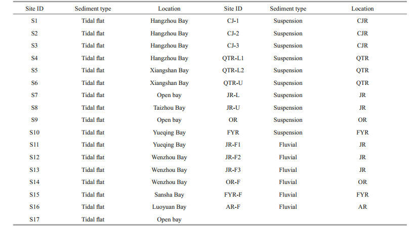
In 2018, 17 locations were selected as typical sites of the intertidal zone in the study area, of which 14 were located in Zhejiang coastal section and 3 in the northern part of Fujian Province (Fig. 1; Table 1). All sites were located away from seaports, main roads, and settlements to limit the influence of vehicular pollution and human interference. The samples were obtained at low tide between 20 and 80 m from the high tide mark. At each site, between 3 and10 samples were collected in space at minimum of 10 m apart and each was analyzed separately so that the magnitude of the variation could be calculated among samples at each site (Wang et al., 2012). A small shovel was used to remove the top 5-cm sediment and then approximately 1 kg of sediment was collected from the layer immediately below, and transported to laboratory in plastic bags. For the modern fluvial samples, 10 suspended sediment and six fluvial (riverbank) sediment samples were collected from the Changjiang River and five other major rivers in this region (Table 1). The fluvial sediment sample sites were in the same localities as the suspended sediment samples, and also situated away from main roads and settlements to avoid pollution and human disturbance. Once collected, the suspended sediment and fluvial samples were stored in plastic containers and frozen for transport to the laboratory. The time between collection and processing was in maximum of four days.
In the laboratory, particles coarser than 1 000 μm (mainly consisting of shell and plant material) were separated through mechanical sieving. The remaining material was oven-dried at 40 ℃ and used for laboratory analyses described below.
2.3 Parameter measurementThe particle size of all samples was measured using a Malvern Mastersizer 2000 laser diffraction particle size analyzer. Samples were pretreated using the protocol of Lu and An (1998) to remove organic matter and carbonate by reaction with 10% hydrogen peroxide (H2O2) and 10% hydrochloric acid (HCl), respectively. After mixing in an appropriate volume of 10% sodium hexametaphosphate (NaPO3)6, ultrasound was used to ensure adequate dispersal of finer particles.
After oven drying at a temperature below 40 ℃, samples were packed into 10-mL plastic vials and subjected to measurement of their magnetic properties. Low-frequency (470 Hz) (χlf) and high-frequency (4 700 Hz) (χhf) magnetic susceptibility were measured using a Bartington MS2 magnetic susceptibility meter. The frequency-dependent magnetic susceptibility (χfd) was calculated as: χfd= χlf-χhf. Anhysteretic remanent magnetization (ARM) was imparted in a 100-mT alternation field with a superimposed 100-μT direct bias field using a Dtech D2000 Demagnetizer, and expressed as the anhysteretic susceptibility (χARM). Saturation isothermal remanent magnetization (SIRM) was imparted at 1T using an MMPM10 Impulse Magnetizer. Subsequently, a reverse field of 300 mT was applied to calculate the hard isothermal remanent magnetization (HIRM) as the reference Hu et al. (2016). All remanence measurements were made with a Mag-instruments Portable Spinning Magnetometer (PSM) magnetometer.
Diffuse reflectance spectroscopy (DRS) measurements of finely powdered samples (< 38 mm) was recorded from 400 to 700 nm at 1-nm steps using a UV-2600 spectrophotometer (Shimadzu Instruments Manufacturing Co., Ltd.). The ratio of hematite (Hm) and goethite (Gt) was estimated by the method of Torrent et al. (2007) and Hu et al. (2016).
Samples for major element analysis were prepared by transferring a known mass of sediment to a column apparatus, together with boric acid, and then pressurized to 30 t/m2 for 20 s. The resultant sample of approximately 4 cm in diameter and 8 mm in thickness was analyzed using Panalytical Epsilon3 X-ray fluorescence (XRF) spectroscope.
All of the magnetic experiments and particle size experiments were performed at the magnetic analysis laboratory and sedimentology laboratory of Zhejiang Normal University. The DRS and geochemical experiments were performed at the Key Laboratory for Subtropical Mountain Ecology, Fujian Normal University.
3 RESULT 3.1 Particle sizeAll particle size results are presented in Supplementary Fig.S1, analyzed by the logarithmic method of moments (Blott and Pye, 2001). The frequency curve of the particle-size distribution is unimodal except in the case of sample S16 that is polymodal. The results suggest that sediment texture distribution is finely skewed or symmetrical, and mostly mesokurtic. Standard deviation (SD) values indicate that the sediments are poorly sorted, more especially in the southern part of the study area. Mean particle size (Mz) lies between 5 and 15 mm, similar, or slightly coarser than that of surface sediment in the subaqueous delta of the Changjiang River (Ge et al., 2017). Sample S9 has the coarsest Mz (almost 20 mm).
3.2 Magnetic susceptibility parametersHigh-temperature magnetic property analysis supports the view that magnetite dominates the magnetic properties of tidal flat sediments in the research area, as evidenced by the temperature curve at 580 ℃ (Fig. 3). Therefore, magnetic susceptibility can be used as a reliable proxy for magnetite concentrations in the tidal flat sediments (Thompson and Oldfield, 1986; Liu et al., 2007b). It is accepted that magnetite may transform to goethite and/or pyrite when in a waterlogged environment for a long time (e.g., Liu et al., 1999). However, the thermomagnetic properties of these sediments do not indicate any distinct evidence for such minerals, thereby supporting the conclusion that little or no transformation of magnetite has occurred since deposition.

|
| Fig.3 Thermomagnetic activities of a typical tidal flat sediment sample of tidal flat sediment Red curve represents values during the heating process, and the blue curve represents values during the cooling process. |
Samples S1-S15 exhibit a stable concentration of magnetite with χlf in the range (45-80)×10-8 m3/kg (Fig. 4a). Samples S16 and S17, located around the estuary of the Jiaoxi and Fujian rivers towards the southern end of the study area, exhibit magnetite concentrations about two to three times higher than the rest. Median absolute deviation (MAD) is a robust measure of parameter variability and most samples here exhibit values below 5×10⁻⁸ m3/kg, although samples S16 and S9 yield much higher values, of 61×10-8 m3/kg and ~8×10⁻⁸ m3/kg, respectively.

|
| Fig.4 Comparison of magnetic characteristics among the study sites 3-10 samples were obtained at each site. |
The magnetic parameter χfd is sensitive to 20-25-nm grain sizes of magnetite (Zhou et al., 1990; Liu et al., 2007b), which is so fine that it can be considered a product of biochemical weathering processes rather than physical processes (Maher and Taylor, 1988; Meng et al., 1997; Oldfield and Crowther, 2007). The χfd parameter values of all tidal flat samples range of (0-7)×10-8 m3/kg, although most lie in the range (2-5)×10-8 m3/kg which suggests that fine-grained magnetite is limited in these tidal flat sediments. Spatially, χfd exhibits an obvious increasing trend from sites S1 to S4 but then decreases from S10 to S15 (Fig. 4b).
χARM is also partly sensitive to the concentration of fine-grained magnetite, especially in the range of 30- 100 nm (Liu et al., 2007b). The tidal flat samples vary between (100-800)×10-8 m3/kg, but mostly in the range (450-750)×10-8 m3/kg. Spatially, χARM follows the pattern in χfd and exhibits a clear increase from S1 to S4 and decreases from S10 to S15 (Fig. 4c). There are some exceptions to this overall pattern; for example, sample S5 has the lowest χfd but an average χARM value, while sample S9 has an average χfd value but the lowest χARM value. This may indicate that fine-grained magnetite has different sources in these cases.
3.3 Isothermal remanent magnetizationSIRM is related to the concentrations of both ferrimagnetic and antiferromagnetic minerals (Hm and Gt), but is generally regarded as only partly sensitive to ferrimagnetic minerals (Thompson and Oldfield, 1986). SIRM values are relatively uniform through sites S1-S15, all falling within the range (292-774)×10-5 Am2/kg. Samples at sites S16 and S17 (Fig. 4d) have somewhat higher values, reaching 1 500×10-5 Am2/kg and 1 000×10-5 Am2/kg on average, respectively (Fig. 4d).
HIRM is particularly sensitive to the concentration of Hm particles with coercivities in the range of 0.3-1 T (France and Oldfield, 2000; Maher et al., 2004; Jia et al., 2018). The values of the samples vary in the range (26-78)×10-5 Am2/kg (Fig. 4e). In a pattern similar to that of SIRM, S16 and S17 yield the highest HIRM value.
3.4 DRSThe Gt content index lies in the range (2-6)×10-4 (Fig. 5a) while the Hm content index varies between (0-3)×10-4 (Fig. 5b). Both parameters, most notably the Hm content index, vary spatially in parallel with changes in χARM, although there is more marked variability. The ratio of Hm/(Hm+Gt) averages 0.6 for sites S1-S15, but is much lower at sites S16 and S17, which is 0.4.

|
| Fig.5 Comparison of Hm and Gt contents among the study sites |
Figure 6 illustrates that the tidal flat sediment samples are enriched in Ti and Fe, but depleted in Na and Ca. Ca and Fe are the most variable elements while Si is most consistent. Spatially, Ca exhibits a distinctly decreasing trend from north to south (Fig. 7f). Meanwhile, Na, also a depleted element, has an opposing trend and increases from north to south (Fig. 7a). Ti values are in general uniform, except for samples from sites S15-S17 (Fig. 7g). Mg, Al, K, Fe all present relatively low concentrations in XS Bay, TZ Bay, and SS Bay, although have high concentrations in HZ Bay and YQ Bay (Fig. 7b, c, e, h). The pattern of variation is similar to that of χARM. In contrast, Si occurs in relatively high concentrations at samples from XS Bay, TZ Bay, and SS Bay, but low concentrations in those from HZ Bay and YQ Bay (Fig. 7d).

|
| Fig.6 The relative abundances (vs UCC) plot for the major elements in the tidal flat samples |

|
| Fig.7 Comparison of geochemical characteristics among the study sites |
In this study, cluster analysis (using fuzzy c-means, after Vriend et al., 1988; Maher et al., 2009) was selected to facilitate identification of any coherent groups among samples of tidal flat sediments in Zhejiang Province. It is generally accepted that the geochemical and magnetic characteristics of sediments are strongly dependent on particle size (e.g. Whitmore et al., 2004; Oldfield et al., 2009; Bouchez et al., 2011; Ge et al., 2017; Li et al., 2017; Jia et al., 2019) and, since the tidal flat sediment in Zhejiang coastal area is texturally variable, a particle-size independent parameter must be selected to avoid the influence of hydrodynamic forces relating to ocean currents or tides. In order to choose the appropriate independent variable, correlation analysis was performed among fifteen parameters in all. The results suggest that Na, Mg, Al, Si, K, Ca, Ti, Fe, χlf, χARM, and SIRM are significantly correlated (P < 0.01) with mean particle size and, for Na, Mg, Al, Si, K, Fe, and χARM, whereby the correlation coefficients all exceed 0.5 (Supplementary Table S1). On the other hand, Hm/(Hm+Gt), χfd, and HIRM are only weakly correlated with sediment particle size. Ti, χlf, SIRM, HIRM, and Hm/(Hm+Gt) are all grouped together by the cluster analysis. And four groups had been identified by cluster analysis (Supplementary Fig.S2; Supplementary Table S2).
Cluster analysis of samples from each site are plotted in Fig. 8, revealing that samples from S17 and part of S15 belong to cluster 1; S6, S9, and part of S5 belong to cluster 2; S1, S11, S12, S13, and S14 mostly belong to cluster 3; S2, S3, S4, S7, S8, and S10 mostly belong to cluster 4 (Fig. 8). In summary, therefore, four groups of sediment samples across the sites are clearly identifiable (Fig. 8, Supplementary Table S3) as follows:

|
| Fig.8 The distribution of samples across each of the four (fuzzy) clusters |
Group 1 samples are from sites S17 and part of S15, located in the northern part of the Fujian coastal area; these are all characterized by high values of χlf and SIRM and low values of Ti content, HIRM, and Hm/(Hm+Gt);
Group 2 samples are from sites S6, S9, and part of S5 and S15, mostly located in the bays which adjacent to hilly areas of the mainland (Fig. 2), and are characterized by relatively low values of χlf and SIRM and high value of Hm/(Hm+Gt);
Group 3 samples are from sites S11, S12, S13, S14, and partly of S1, S2, S5, and S10, mostly located in the south of Zhejiang coastal area or in the semi-enclosed bay in the north of the Zhejiang coastal area; these are characterized by relatively high values of Hm/(Hm+Gt) and Ti content;
Group 4 samples are from sites S3, S4, S7, S8, and partly of S1, S2, and S10, mostly located in the north of the Zhejiang coastal area; and are characterized by significantly higher values of Ti content and HIRM;
Unclassified samples with extreme values are mostly from sites S16 and S17, located in the Fujian coastal area, and are characterized by significantly higher values of χlf and SIRM.
4.2 Binary mixing of the muddy sediment along the Zhejiang coastal areaIn order to identify the sources of the tidal flat deposits in the Zhejiang Province, suspended material was sampled and subject to a similar range of analysis as the mudflat sediments (Fig. 2). In terms of the characteristics of its major river catchments, Zhejiang Province can be geologically divided into two parts by the Jiang-Shao fault (Fig. 2). The northern part belongs to the Yangtze block, where Ordovician and Silurian sandstone, siltstone, and mudstone are widely distributed (Ma, 2002). The southern part belongs to the Cathaysian block associated with Jurassic and Cretaceous rhyolite, sedimentary tuff, and sandstone (Ma, 2002). Due to their dependence on parent rock characteristics (Thompson and Oldfield, 1986), the magnetic and geochemical characteristics of the river and coastal sediments in these two regions should be different. Scatter plots of the magnetic and chemical properties of suspended sediment samples do indeed indicate a natural division into two clearly distinguishable groups (Fig. 9). One group, labelled the Zhejiang river group, includes samples from the OR, and FYR, that are all located in the southern part of the study area. The second group includes suspended sediment samples from the CJR and QTR, located in the north of the study area, and labelled CJR-QTR river group. The Qiantang River is characterized by a discharge that is only approximately 3%-4% of the Changjiang River and this, coupled with the fact that their estuaries are very close to each other, suggests that the material contribution of QTR is negligible compared to the other rivers.

|
| Fig.9 Magnetic and geochemical scatter plots of the tidal flat, suspended, and fluvial samples The error bars represent the standard deviation of characteristic data from each group and each site. The data for ocean sediment from the estuary of CJR (YRE) is obtained from Ge et al. (2017). Red dots represent the three groups calculated by (fuzzy) cluster analysis. The yellow and cyan shaded areas represent the two source regions. |
The ocean sediment from the estuary of JCR (YRE) in Fig. 9 symbolizes the magnetic and geochemical characteristics of sediments from the southern part of the Changjiang River estuary, originally reported in Ge et al. (2017). This location approximates the sites of suspended sediment samples from CJR and QTR in this study and supports the use of the magnetic and geochemical tracing method to identify the source of coastal sediment.
As Fig. 9 shows, the suspended sediment is characterized by high concentrations of magnetite and coercive hematite from the CJR-QTR river group, and low concentrations of magnetite and coercive hematite from the Zhejiang river group. The reason for low concentrations of magnetic minerals in the sediment is in part due to the acidic volcanic nature of parent rock in the area, the magnetic susceptibility of which is usually relatively low. The tidal flat samples from the Zhejiang coastline have characteristics that are intermediate between the suspended sediments of the CJR-QTR river group and the Zhejiang river group. This strongly supports the conclusion that tidal flat sediments in the Zhejiang coastal area have a binary sediment source. The material contribution from CJR and QTR decreases in the sequence of: Group 4 > Group 3 > Group 2 due to their progressive locational distance from those rivers (Fig. 9). Sediments of Group 4 are located in the open bays in the northern part of the Zhejiang coastal area, sediments of Group 3 are located in the southern part and partly in the semi-closed bays in the northern section of the Zhejiang coast, while, sediments of Group 2 are located in the bays adjacent to the hilly part of the mainland (indicating a low deposition flux). Accordingly, we propose that both distance to the CJR estuary and the geomorphological characteristics of the coast strongly influence the material contribution of CJR to Zhejiang coastal sediments.
Yueqing Bay is shown to represent an important boundary, beyond which the material contribution from CJR is markedly decreased, as indicated by the fact that samples from WZ Bay, located southward of YQ Bay, all belong to Cluster 3. This suggests that the material contribution from OR is very important to the surrounding sediment, while, tidal flat sediment in the area still has two dominated sources, both CJR and local Zhejiang rivers. SS Bay is another important boundary, since sediments here exhibit distinctly different geochemical and magnetic characteristics compared to all other samples from the Zhejiang coast. This observation further supports the contention that suspended material from CJR is not the dominant source of the fresh muddy sediment in the Fujian coastal area.
5 CONCLUSIONThe geochemistry and magnetic properties of tidal flat sediment samples from the Zhejiang coastal area are distinctive and, critically, display minimal overlap with the characteristics of the CJR suspended material. Comparison with suspended sediment from both local rivers and the CJR suggests that the tidal flats of the study area have binary sources of sediment, whereby the majority originates locally. Further south, the tidal flats of Fujian have sediments that are entirely sourced from local rivers and this part of the coastline has practically no material link with the CJR. It must be noted that the situation may have been different before the construction of the Three Gorges Dam, which has significantly reduced sediment flux to the Changjiang estuary and certainly warrants further research.
Our study suggests that, although the CJR may transport a huge sediment load to the south, the material is only rarely deposited along the shoreline and, accordingly, the material contribution of Changjiang sediments to the tidal flats of the Zhejiang coastal area has been overestimated, with implications for future management.
6 DATA AVAILABILITY STATEMENTAll data generated or analyzed during this study are included in this published article and its supplementary information file (Supplementary Table S4).
7 ACKNOWLEDGMENTWe thank Dr. Zhiyuan WANG and Bo WANG for the fieldwork.
Electronic supplementary materialSupplementary material (Supplementary Figs.S1–S2 and Supplementary Tables S1–S4) is available in the online version of this article at https://doi.org/10.1007/s00343-020-0179-2.
Bi L, Yang S Y, Zhao Y, Wang Z B, Dou Y G, Li C, Zheng H B. 2017. Provenance study of the Holocene sediments in the Changjiang (Yangtze River) estuary and inner shelf of the East China Sea. Quaternary International, 441: 147-161.
DOI:10.1016/j.quaint.2016.12.004 |
Blott S J, Pye K. 2001. Gradistat: a grain size distribution and statistics package for the analysis of unconsolidated sediments. Earth Surface Processes and Landforms, 26(11): 1 237-1 248.
DOI:10.1002/esp.261 |
Bouchez J, Gaillardet J, France-Lanord C, Maurice L, Maurice L, Dutra-Maia P. 2011. Grain size control of river suspended sediment geochemistry: clues from Amazon River depth profiles. Geochemistry, Geophysics, Geosystems, 12(3): Q03008.
DOI:10.1029/2010GC003380 |
Dong Y, Zhang W G, Dong C Y, Ge C, Yu L Z. 2014. Magnetic and diffuse reflectance spectroscopic characterization of iron oxides in the tidal flat sequence from the coastal plain of Jiangsu Province, China. Geophysical Journal International, 196(1): 175-188.
DOI:10.1093/gji/ggt399 |
France D E, Oldfield F. 2000. Identifying goethite and hematite from rock magnetic measurements of soils and sediments. Journal of Geophysical Research: Solid Earth, 105(B2): 2 781-2 795.
DOI:10.1029/1999JB900304 |
Gao S, Collins M B. 2014. Holocene sedimentary systems on continental shelves. Marine Geology, 352: 268-294.
DOI:10.1016/j.margeo.2014.03.021 |
Ge C, Zhang W G, Dong C Y, Wang F, Feng H, Qu J G, Yu L Z. 2017. Tracing sediment erosion in the Yangtze River subaqueous delta using magnetic methods. Journal of Geophysical Research: Earth Solid, 122(11): 2 064-2 078.
DOI:10.1002/2017JF004403 |
Guo L C, Su N, Zhu C Y, He Q. 2018. How have the river discharges and sediment loads changed in the Changjiang River basin downstream of the Three Gorges Dam?. Journal of Hydrology, 560: 259-274.
DOI:10.1016/j.jhydrol.2018.03.035 |
Hu P X, Jiang Z X, Liu Q S, Heslop D, Roberts A P, Torrent J, Borrón V. 2016. Estimating the concentration of aluminum-substituted hematite and goethite using diffuse reflectance spectrometry and rock magnetism: feasibility and limitations. Journal of Geophysical Research: Solid Earth, 121(6): 4 180-4 194.
DOI:10.1002/2015JB012635 |
Jia J, Lu H, Wang Y J, Xia D S. 2018. Variations in the iron mineralogy of a loess section in Tajikistan during the mid-pleistocene and late pleistocene: implications for the climatic evolution in Central Asia. Geochemistry, Geophysics, Geosystems, 19(4): 1 244-1 258.
DOI:10.1002/2017GC007371 |
Jia J, Wang Y J, Xia D S, Lu H, Gao F Y. 2019. Dust sources of last glacial Chinese loess based on the iron mineralogy of fractionated source samples. Geophysical Research Letters, 46(4): 2 103-2 110.
DOI:10.1029/2018GL080909 |
Li J L, Tian P, Shao S Y, Wang H F, Wang L J, Ye M Y, Zhao M Q, Zhang K Q, Cai K T, Yuan Y C, Shen X W. 2019. The change of continental coastline and its development and utilization intensity in the East China Sea. Journal of Natural Resources, 34(9): 1 886-1 901.
(in Chinese with English abstract) DOI:10.31497/zrzyxb.20190907 |
Li W, Hu Z X, Zhang W G, Ji R, Nguyen T T H. 2017. Influence of provenance and hydrodynamic sorting on the magnetic properties and geochemistry of sediments of the Oujiang River, China. Marine Geology, 387: 1-11.
DOI:10.1016/j.margeo.2017.03.002 |
Li X Z, Sun Y G, Mander ü, He Y L. 2013. Effects of land use intensity on soil nutrient distribution after reclamation in an estuary landscape. Landscape Ecology, 28(4): 699-707.
DOI:10.1007/s10980-012-9796-2 |
Liao T, Cai T L, Liu Y F, Xia X M. 2016. Continental shoreline change in Zhejiang during the last one hundred years. Journal of Marine Sciences, 34(3): 25-33.
(in Chinese with English abstract) |
Liu J P, Li A C, Xu K H, Velozzi D M, Yang Z S, Milliman J D, DeMaster D J. 2006. Sedimentary features of the Yangtze River-derived along-shelf clinoform deposit in the East China Sea. Continental Shelf Research, 26(17-18): 2 141-2 156.
DOI:10.10167/j.csr.2006.07.013 |
Liu J P, Xu K H, Li A C, Milliman J D, Velozzi D M, Xiao S B, Yang Z S. 2007a. Flux and fate of Yangtze River sediment delivered to the East China Sea. Geomorphology, 85(3-4): 208-224.
DOI:10.1016/j.geomorph.2006.03.023 |
Liu Q S, Deng C L, Torrent J, Zhu R X. 2007b. Review of recent developments in mineral magnetism of the Chinese loess. Quaternary Science Reviews, 26(3-4): 368-385.
DOI:10.1016/j.quascirev.2006.08.004 |
Liu X M, Hesse P, Rolph T, Begét J E. 1999. Properties of magnetic mineralogy of Alaskan loess: evidence for pedogenesis. Quaternary International, 62(1): 93-102.
DOI:10.1016/S1040-6182(99)00027-0 |
Lu H Y, An Z S. 1998. Pretreated methods on loess-palaeosol samples granulometry. Chinese Science Bulletin, 43(3): 237-240.
DOI:10.1007/BF02898920 |
Lu X Y, Zeng J N. 2006. Dynamic variety analysis of tidal flat resources in Zhejiang province. Journal of Marine Sciences, 24: 67-72.
(in Chinese with English abstract) |
Ma L F. 2002. Geological Atlas of China. Geological Press, Beijing.
(in Chinese)
|
Maher B A, Karloukovski V V, Mutch T J. 2004. High-field remanence properties of synthetic and natural submicrometre haematites and goethites: significance for environmental contexts. Earth and Planetary Science Letters, 226(3-4): 491-505.
DOI:10.1016/j.epsl.2004.05.042 |
Maher B A, Taylor R M. 1988. Formation of ultrafine-grained magnetite in soils. Nature, 336(6197): 368-370.
DOI:10.1038/336368a0 |
Maher B A, Watkins S J, Brunskill G, Alexander J, Fielding C R. 2009. Sediment provenance in a tropical fluvial and marine context by magnetic 'fingerprinting' of transportable sand fractions. Sedimentology, 56(3): 841-861.
DOI:10.1111/j.1365-3091.2008.00999.x |
Meng X M, Derbyshire E, Kemp R A. 1997. Origin of the magnetic susceptibility signal in Chinese loess. Quaternary Science Reviews, 16(8): 833-839.
DOI:10.1016/S0277-3791(97)00053-X |
Oldfield F, Crowther J. 2007. Establishing fire incidence in temperate soils using magnetic measurements. Palaeogeography, Palaeoclimatology, Palaeoecology, 249(3-4): 362-369.
DOI:10.1016/j.palaeo.2007.02.007 |
Oldfield F, Hao Q Z, Bloemendal J, Gibbs-Eggar Z, Patil S, Guo Z T. 2009. Links between bulk sediment particle size and magnetic grain-size: general observations and implications for Chinese loess studies. Sedimentology, 56(7): 2 091-2 106.
DOI:10.1111/j.1365-3091.2009.01071.x |
Pekel J F, Cottam A, Gorelick N, Belward A S. 2016. Highresolution mapping of global surface water and its long-term changes. Nature, 540(7633): 418-422.
DOI:10.1038/nature20584 |
Sengupta D, Chen R S, Meadows M E, Banerjee A. 2020. Gaining or losing ground? Tracking Asia's hunger for 'new' coastal land in the era of sea level rise. Science of the Total Environment, 732: 139290.
DOI:10.1016/j.scitotenv.2020.139290 |
Thompson R, Oldfield F. 1986. Environmental Magnetism. Allen & Unwin, London.
|
Torrent J, Liu Q S, Bloemendal J, Barrón V. 2007. Magnetic enhancement and iron oxides in the upper Luochuan loess-paleosol sequence, Chinese Loess Plateau. Soil Science Society of America Journal, 71(5): 1 570-1 578.
DOI:10.2136/sssaj2006.0328 |
Vriend S P, van Gaans P F M, Middelburg J, de Nus A. 1988. The application of fuzzy c-means cluster analysis and non-linear mapping to geochemical datasets: examples from Portugal. Applied Geochemistry, 3(2): 213-224.
DOI:10.1016/0883-2927(88)90009-1 |
Wang W, Liu H, Li Y Q, Su J L. 2014. Development and management of land reclamation in China. Ocean & Coastal Management, 102: 415-525.
|
Wang X M, Xia D S, Zhang C X, Lang L L, Hua T, Zhao S. 2012. Geochemical and magnetic characteristics of finegrained surface sediments in potential dust source areas: implications for tracing the provenance of aeolian deposits and associated palaeoclimatic change in East Asia. Palaeogeography, Palaeoclimatology, Palaeoecology, 323-325: 123-132.
DOI:10.1016/j.palaeo.2012.02.005 |
Wang X X, Xiao X M, Zou Z H, Chen B Q, Ma J, Dong J W, Doughty R B, Zhong Q Y, Qin Y W, Dai S Q, Li X P, Zhao B, Li B. 2020. Tracking annual changes of coastal tidal flats in China during 1986-2016 through analyses of Landsat images with Google Earth Engine. Remote Sensing of Environment, 238: 110987.
DOI:10.1016/j.rse.2018.11.030 |
Whitmore G P, Crook K A W, Johnson D P. 2004. Grain size control of mineralogy and geochemistry in modern river sediment, New Guinea collision, Papua New Guinea. Sediment Geology, 171(1-4): 129-157.
DOI:10.1016/j.sedgeo.2004.03.011 |
Wu M, Shao X X, Hu F, Jiang K Y. 2008. Effects of reclamation on soil nutrients distribution of coastal wetland in South Hangzhou Bay. Soils, 40(5): 760-764.
(in Chinese with English abstract) |
Xu C Y, Pu L J, Zhu M. 2018. Effect of reclamation activity on coastal ecological environment: progress and perspectives. Acta Ecologica Sinica, 38(3): 1 148-1 162.
(in Chinese with English abstract) |
Xu F J, Li A C, Li T G, Xu K H, Chen S Y, Qiu L W, Cao Y C. 2011. Rare earth element geochemistry in the inner shelf of the East China Sea and its implication to sediment provenances. Journal of Rare Earths, 29(7): 702-709.
DOI:10.1016/S1002-0721(10)60526-1 |
Zhou L P, Oldfield F, Wintle A G, Robinson S G, Wang J T. 1990. Partly pedogenic origin of magnetic variations in Chinese loess. Nature, 346(6286): 737-739.
DOI:10.1038/346737a0 |